
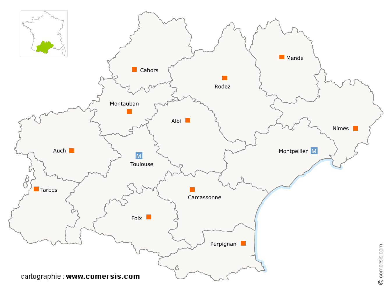
Supermarchés, Hypermarchés en région Occitanie
1 426 supermarchés sont référencés sur la région Occitanie
Vous recherchez un supermarché ou un hyper en Occitanie ?
La région Occitanie représente 8% des supermarchés de France.
C'est le département de Haute-Garonne qui compte le plus de supermarchés en Occitanie.
C'est le département de Haute-Garonne qui compte le plus de supermarchés en Occitanie.
Supermarchés, Hypermarchés en Haute-Garonne (31)
Secteur de Toulouse
Indice d'implantation
| Commune | Nb Pro | Habitants | Distance | |
|---|---|---|---|---|
| Toulouse - 31000 | 139 | 458298 | 0,0 | km |
Secteur de Colomiers
Indice d'implantation
| Commune | Nb Pro | Habitants | Distance | |
|---|---|---|---|---|
| Colomiers - 31770 | 8 | 38302 | 0,0 | km |
| Pibrac - 31820 | 2 | 8252 | 4,5 | km |
| Cornebarrieu - 31700 | 2 | 5930 | 4,5 | km |
| Blagnac - 31700 | 15 | 22969 | 5,3 | km |
| Beauzelle - 31700 | 2 | 5824 | 7,1 | km |
| Mondonville - 31700 | 1 | 4554 | 7,9 | km |
| Brax - 31490 | 1 | 2686 | 8,0 | km |
| Aussonne - 31840 | 1 | 6867 | 8,2 | km |
| Fenouillet - 31150 | 2 | 5113 | 8,7 | km |
| Aucamville - 31140 | 1 | 8126 | 9,4 | km |
| Saint-Alban - 31140 | 3 | 5824 | 10,9 | km |
| Fonbeauzard - 31140 | 3 | 2899 | 11,6 | km |
| Castelginest - 31780 | 3 | 9691 | 11,7 | km |
| Launaguet - 31140 | 1 | 7817 | 11,8 | km |
| Bruguières - 31150 | 1 | 5192 | 14,3 | km |
| Gratentour - 31150 | 1 | 3535 | 14,4 | km |
| Saint-Jean - 31240 | 2 | 10358 | 14,6 | km |
| Montrabé - 31850 | 1 | 3930 | 15,4 | km |
Secteur de Tournefeuille
Indice d'implantation
| Commune | Nb Pro | Habitants | Distance | |
|---|---|---|---|---|
| Tournefeuille - 31170 | 5 | 26206 | 0,0 | km |
| Cugnaux - 31270 | 5 | 16638 | 5,3 | km |
| Balma - 31130 | 3 | 14929 | 12,4 | km |
| l'Union - 31240 | 2 | 11731 | 13,5 | km |
| Saint-Orens-de-Gameville - 31650 | 2 | 11243 | 16,1 | km |
| Quint-Fonsegrives - 31130 | 1 | 5118 | 16,8 | km |
| Flourens - 31130 | 2 | 1857 | 17,3 | km |
| Saint-Jory - 31790 | 4 | 5637 | 17,7 | km |
| Drémil-Lafage - 31280 | 1 | 2477 | 20,5 | km |
Secteur de Grenade
Indice d'implantation
| Commune | Nb Pro | Habitants | Distance | |
|---|---|---|---|---|
| Grenade - 31330 | 5 | 8430 | 0,0 | km |
| Castelnau-d'Estrétefonds - 31620 | 1 | 5912 | 5,5 | km |
| Merville - 31330 | 1 | 4979 | 5,6 | km |
| Bouloc - 31620 | 1 | 4323 | 9,1 | km |
| Fronton - 31620 | 6 | 5736 | 10,8 | km |
| Pechbonnieu - 31140 | 1 | 4251 | 16,0 | km |
| Villemur-sur-Tarn - 31340 | 4 | 5763 | 19,5 | km |
| Cadours - 31480 | 1 | 1092 | 20,1 | km |
| Cox - 31480 | 1 | 343 | 20,2 | km |
| Bessières - 31660 | 3 | 3625 | 25,5 | km |
Secteur de Ramonville-Saint-Agne
Indice d'implantation
| Commune | Nb Pro | Habitants | Distance | |
|---|---|---|---|---|
| Ramonville-Saint-Agne - 31520 | 3 | 13475 | 0,0 | km |
| Auzeville-Tolosane - 31320 | 1 | 3564 | 1,9 | km |
| Castanet-Tolosan - 31320 | 2 | 12388 | 3,9 | km |
| Labège - 31670 | 1 | 4260 | 4,9 | km |
| Lacroix-Falgarde - 31120 | 3 | 2036 | 7,3 | km |
| Escalquens - 31750 | 2 | 6170 | 7,8 | km |
| Belberaud - 31450 | 1 | 1314 | 8,8 | km |
| Montgiscard - 31450 | 1 | 2143 | 12,8 | km |
| Rouffiac-Tolosan - 31180 | 3 | 1908 | 13,9 | km |
| Lanta - 31570 | 1 | 1808 | 14,7 | km |
| Ayguesvives - 31450 | 1 | 2486 | 15,5 | km |
| Labastide-Beauvoir - 31450 | 1 | 1139 | 17,0 | km |
| Verfeil - 31590 | 1 | 3384 | 19,4 | km |
| Garidech - 31380 | 1 | 1712 | 19,4 | km |
| Bourg-Saint-Bernard - 31570 | 1 | 979 | 20,2 | km |
| Montastruc-la-Conseillère - 31380 | 1 | 3244 | 21,3 | km |
Secteur de Cazères
Indice d'implantation
| Commune | Nb Pro | Habitants | Distance | |
|---|---|---|---|---|
| Cazères - 31220 | 7 | 4877 | 0,0 | km |
| Palaminy - 31220 | 1 | 811 | 1,2 | km |
| Martres-Tolosane - 31220 | 1 | 2247 | 6,0 | km |
| Boussens - 31360 | 1 | 1116 | 9,8 | km |
| Montesquieu-Volvestre - 31310 | 2 | 3205 | 11,7 | km |
| Carbonne - 31390 | 4 | 5330 | 14,9 | km |
| Salies-du-Salat - 31260 | 3 | 1818 | 15,3 | km |
| Mane - 31260 | 3 | 990 | 17,5 | km |
| Rieumes - 31370 | 1 | 3496 | 23,0 | km |
Secteur de Muret
Indice d'implantation
| Commune | Nb Pro | Habitants | Distance | |
|---|---|---|---|---|
| Muret - 31600 | 6 | 24725 | 0,0 | km |
| Seysses - 31600 | 1 | 7954 | 4,3 | km |
| Eaunes - 31600 | 1 | 5782 | 5,1 | km |
| Pins-Justaret - 31860 | 2 | 4514 | 5,1 | km |
| Frouzins - 31270 | 1 | 8620 | 6,1 | km |
| Labarthe-sur-Lèze - 31860 | 1 | 5140 | 6,1 | km |
| Roques - 31120 | 2 | 4244 | 6,8 | km |
| Pinsaguel - 31120 | 1 | 2737 | 7,4 | km |
| Lavernose-Lacasse - 31410 | 1 | 2792 | 9,0 | km |
| Portet-sur-Garonne - 31120 | 3 | 9510 | 9,5 | km |
| Fonsorbes - 31470 | 2 | 11786 | 11,3 | km |
| Saint-Lys - 31470 | 2 | 8917 | 13,5 | km |
Secteur de Saint-Gaudens
Indice d'implantation
| Commune | Nb Pro | Habitants | Distance | |
|---|---|---|---|---|
| Saint-Gaudens - 31800 | 4 | 11241 | 0,0 | km |
| Estancarbon - 31800 | 2 | 625 | 5,1 | km |
| Landorthe - 31800 | 1 | 971 | 5,5 | km |
| Ausson - 31210 | 1 | 547 | 10,9 | km |
| Aspet - 31160 | 2 | 961 | 12,4 | km |
| Gourdan-Polignan - 31210 | 2 | 1315 | 12,9 | km |
| Saint-Plancard - 31580 | 1 | 354 | 13,9 | km |
| Saint-Pé-d'Ardet - 31510 | 1 | 122 | 14,7 | km |
| Nizan-Gesse - 31350 | 2 | 79 | 17,2 | km |
| Boulogne-sur-Gesse - 31350 | 1 | 1605 | 21,1 | km |
| l'Isle-en-Dodon - 31230 | 2 | 1861 | 31,6 | km |
| Moustajon - 31110 | 1 | 169 | 34,4 | km |
| Bagnères-de-Luchon - 31110 | 3 | 2533 | 36,9 | km |
Secteur d'Auterive
Indice d'implantation
| Commune | Nb Pro | Habitants | Distance | |
|---|---|---|---|---|
| Auterive - 31190 | 3 | 9252 | 0,0 | km |
| Venerque - 31810 | 1 | 2580 | 9,3 | km |
| Vernet - 31810 | 2 | 2413 | 9,7 | km |
| Nailloux - 31560 | 1 | 3478 | 11,6 | km |
| Saint-Sulpice-sur-Lèze - 31410 | 1 | 2049 | 13,1 | km |
| Villefranche-de-Lauragais - 31290 | 2 | 4235 | 20,0 | km |
Secteur de Revel
Indice d'implantation
| Commune | Nb Pro | Habitants | Distance | |
|---|---|---|---|---|
| Revel - 31250 | 4 | 9364 | 0,0 | km |
| la Salvetat-Lauragais - 31460 | 2 | 137 | 19,2 | km |
| Caraman - 31460 | 1 | 2347 | 21,2 | km |
Secteur de Plaisance-du-Touch
Indice d'implantation
| Commune | Nb Pro | Habitants | Distance | |
|---|---|---|---|---|
| Plaisance-du-Touch - 31830 | 3 | 17126 | 0,0 | km |
| Léguevin - 31490 | 1 | 8692 | 6,3 | km |
Supermarchés, Hypermarchés dans le Gers (32)
Secteur d'Auch
Indice d'implantation
| Commune | Nb Pro | Habitants | Distance | |
|---|---|---|---|---|
| Auch - 32000 | 11 | 21962 | 0,0 | km |
| Pavie - 32550 | 1 | 2426 | 3,9 | km |
| Seissan - 32260 | 2 | 1085 | 16,9 | km |
| Mirande - 32300 | 2 | 3572 | 20,7 | km |
| Masseube - 32140 | 1 | 1534 | 23,9 | km |
| Miélan - 32170 | 1 | 1219 | 33,1 | km |
| Marciac - 32230 | 5 | 1252 | 36,9 | km |
| Plaisance - 32160 | 2 | 1499 | 43,9 | km |
Secteur de Condom
Indice d'implantation
| Commune | Nb Pro | Habitants | Distance | |
|---|---|---|---|---|
| Condom - 32100 | 3 | 7003 | 0,0 | km |
| Gondrin - 32330 | 1 | 1136 | 13,3 | km |
| Marambat - 32190 | 1 | 463 | 20,6 | km |
| Vic-Fezensac - 32190 | 3 | 3563 | 22,7 | km |
| Eauze - 32800 | 3 | 3877 | 24,3 | km |
| Aignan - 32290 | 4 | 740 | 37,2 | km |
| Nogaro - 32110 | 2 | 1960 | 39,4 | km |
| Toujouse - 32240 | 2 | 221 | 46,1 | km |
| le Houga - 32460 | 2 | 1193 | 48,6 | km |
| Riscle - 32400 | 1 | 1 | 49,7 | km |
Secteur d'Isle-Jourdain
Indice d'implantation
| Commune | Nb Pro | Habitants | Distance | |
|---|---|---|---|---|
| l'Isle-Jourdain - 32600 | 3 | 8012 | 0,0 | km |
| Gimont - 32200 | 3 | 2871 | 16,7 | km |
| Samatan - 32130 | 2 | 2401 | 18,1 | km |
| Lombez - 32220 | 1 | 2070 | 20,6 | km |
| Mauvezin - 32120 | 1 | 2066 | 20,9 | km |
Secteur de Fleurance
Indice d'implantation
| Commune | Nb Pro | Habitants | Distance | |
|---|---|---|---|---|
| Fleurance - 32500 | 4 | 6280 | 0,0 | km |
| Saint-Clar - 32380 | 1 | 996 | 9,9 | km |
| Lectoure - 32700 | 2 | 3730 | 10,0 | km |
| Miradoux - 32340 | 1 | 530 | 18,2 | km |
| Solomiac - 32120 | 1 | 518 | 19,6 | km |
Supermarchés, Hypermarchés en Lozère (48)
Secteur de Mende
Indice d'implantation
| Commune | Nb Pro | Habitants | Distance | |
|---|---|---|---|---|
| Mende - 48000 | 3 | 11679 | 0,0 | km |
| Esclanèdes - 48230 | 1 | 356 | 11,6 | km |
| Marvejols - 48100 | 3 | 4907 | 17,0 | km |
| Florac - 48400 | 1 | 2130 | 22,8 | km |
| la Canourgue - 48500 | 1 | 2126 | 24,7 | km |
| Banassac - 48500 | 1 | 1036 | 25,5 | km |
| Aumont-Aubrac - 48130 | 1 | 1094 | 28,2 | km |
| Saint-Alban-sur-Limagnole - 48120 | 2 | 1396 | 30,5 | km |
| Villefort - 48800 | 1 | 604 | 35,8 | km |
| Saint-Chély-d'Apcher - 48200 | 5 | 4162 | 36,3 | km |
| Langogne - 48300 | 7 | 2944 | 36,5 | km |
| Meyrueis - 48150 | 1 | 823 | 38,3 | km |
| Nasbinals - 48260 | 1 | 509 | 39,3 | km |
| le Malzieu-Ville - 48140 | 1 | 749 | 39,8 | km |
Supermarchés, Hypermarchés dans les Hautes-Pyrénées (65)
Secteur de Tarbes
Indice d'implantation
| Commune | Nb Pro | Habitants | Distance | |
|---|---|---|---|---|
| Tarbes - 65000 | 18 | 41062 | 0,0 | km |
| Aureilhan - 65800 | 2 | 7959 | 2,4 | km |
| Séméac - 65600 | 4 | 4713 | 2,8 | km |
| Bordères-sur-l'Échez - 65320 | 2 | 4733 | 3,3 | km |
| Laloubère - 65310 | 2 | 1944 | 3,3 | km |
| Soues - 65430 | 3 | 3033 | 4,0 | km |
| Odos - 65310 | 2 | 3235 | 4,2 | km |
| Juillan - 65290 | 1 | 4076 | 5,2 | km |
| Ibos - 65420 | 1 | 2827 | 5,6 | km |
| Orleix - 65800 | 1 | 2017 | 6,5 | km |
| Pouyastruc - 65350 | 1 | 706 | 8,9 | km |
| Ossun - 65380 | 1 | 2314 | 9,6 | km |
| Tournay - 65190 | 1 | 1358 | 15,2 | km |
| Vic-en-Bigorre - 65500 | 3 | 4990 | 17,0 | km |
| Lourdes - 65100 | 3 | 14644 | 18,1 | km |
| Rabastens-de-Bigorre - 65140 | 2 | 1478 | 18,2 | km |
| Lalanne-Trie - 65220 | 1 | 113 | 23,3 | km |
| Saint-Pé-de-Bigorre - 65270 | 1 | 1211 | 23,7 | km |
| Maubourguet - 65700 | 3 | 2446 | 26,2 | km |
| Castelnau-Magnoac - 65230 | 1 | 768 | 35,9 | km |
Secteur de Bagnères-de-Bigorre
Indice d'implantation
| Commune | Nb Pro | Habitants | Distance | |
|---|---|---|---|---|
| Bagnères-de-Bigorre - 65200 | 5 | 7633 | 0,0 | km |
| Pouzac - 65200 | 2 | 1119 | 2,6 | km |
| Campan - 65710 | 1 | 1345 | 5,8 | km |
| Capvern - 65130 | 1 | 1293 | 13,8 | km |
| Lannemezan - 65300 | 2 | 5940 | 19,9 | km |
| Campistrous - 65300 | 2 | 309 | 20,8 | km |
| Arreau - 65240 | 3 | 819 | 24,8 | km |
| Ancizan - 65440 | 1 | 284 | 26,2 | km |
| Saint-Lary-Soulan - 65170 | 2 | 892 | 30,9 | km |
| Aragnouet - 65170 | 1 | 242 | 31,4 | km |
| Loudenvielle - 65510 | 1 | 284 | 36,5 | km |
| Loures-Barousse - 65370 | 1 | 611 | 37,2 | km |
Secteur d'Argelès-Gazost
Indice d'implantation
| Commune | Nb Pro | Habitants | Distance | |
|---|---|---|---|---|
| Esquièze-Sère - 65120 | 1 | 390 | 0,0 | km |
| Argelès-Gazost - 65400 | 3 | 3048 | 0,0 | km |
| Cauterets - 65110 | 6 | 1002 | 13,3 | km |
Supermarchés, Hypermarchés dans le Tarn (81)
Secteur de Castres
Indice d'implantation
| Commune | Nb Pro | Habitants | Distance | |
|---|---|---|---|---|
| Castres - 81100 | 14 | 41636 | 0,0 | km |
| Labruguière - 81290 | 3 | 6442 | 7,8 | km |
| Sémalens - 81570 | 1 | 2023 | 10,6 | km |
| Lacrouzette - 81210 | 1 | 1734 | 10,8 | km |
| Soual - 81580 | 1 | 2425 | 11,5 | km |
| Payrin-Augmontel - 81660 | 1 | 2202 | 13,0 | km |
| Aussillon - 81200 | 2 | 6148 | 16,3 | km |
| Mazamet - 81200 | 3 | 10118 | 16,7 | km |
| Pont-de-Larn - 81660 | 1 | 2886 | 17,6 | km |
| Puylaurens - 81700 | 4 | 3255 | 18,9 | km |
| Albine - 81240 | 1 | 524 | 29,1 | km |
| Labastide-Rouairoux - 81270 | 1 | 1418 | 35,4 | km |
| Lacaune - 81230 | 3 | 2536 | 37,9 | km |
| Fraisse-sur-Agout - 34330 | 1 | 343 | 44,9 | km |
Secteur d'Albi
Indice d'implantation
| Commune | Nb Pro | Habitants | Distance | |
|---|---|---|---|---|
| Albi - 81000 | 20 | 49342 | 0,0 | km |
| le Sequestre - 81990 | 2 | 1521 | 2,7 | km |
| Lescure-d'Albigeois - 81380 | 2 | 4468 | 3,5 | km |
| Puygouzon - 81990 | 1 | 2951 | 3,8 | km |
| Saint-Juéry - 81160 | 1 | 6749 | 5,9 | km |
| Fréjairolles - 81990 | 1 | 1314 | 8,8 | km |
| Marssac-sur-Tarn - 81150 | 1 | 3014 | 9,1 | km |
| Réalmont - 81120 | 1 | 3330 | 17,4 | km |
| Alban - 81250 | 1 | 931 | 26,0 | km |
Secteur de Gaillac
Indice d'implantation
| Commune | Nb Pro | Habitants | Distance | |
|---|---|---|---|---|
| Gaillac - 81600 | 6 | 14334 | 0,0 | km |
| Brens - 81600 | 2 | 2250 | 1,8 | km |
| Lagrave - 81150 | 1 | 2007 | 7,9 | km |
| Lisle-sur-Tarn - 81310 | 3 | 4440 | 8,8 | km |
| Rabastens - 81800 | 2 | 5290 | 16,4 | km |
| Graulhet - 81300 | 6 | 11807 | 17,0 | km |
Secteur de Lavaur
Indice d'implantation
| Commune | Nb Pro | Habitants | Distance | |
|---|---|---|---|---|
| Lavaur - 81500 | 10 | 10691 | 0,0 | km |
| Cambon-lès-Lavaur - 81470 | 1 | 299 | 13,0 | km |
| Saint-Sulpice - 81370 | 5 | 8484 | 13,2 | km |
Secteur de Carmaux
Indice d'implantation
| Commune | Nb Pro | Habitants | Distance | |
|---|---|---|---|---|
| Carmaux - 81400 | 4 | 9688 | 0,0 | km |
| Blaye-les-Mines - 81400 | 1 | 3073 | 3,0 | km |
| Cagnac-les-Mines - 81130 | 1 | 2353 | 6,7 | km |
| Valence-d'Albigeois - 81340 | 2 | 1311 | 20,2 | km |
Supermarchés, Hypermarchés dans les Pyrénées-Orientales (66)
Secteur de Perpignan
Indice d'implantation
| Commune | Nb Pro | Habitants | Distance | |
|---|---|---|---|---|
| Perpignan - 66000 | 54 | 120959 | 0,0 | km |
Secteur de Canet-en-Roussillon
Indice d'implantation
| Commune | Nb Pro | Habitants | Distance | |
|---|---|---|---|---|
| Canet-en-Roussillon - 66140 | 8 | 12436 | 0,0 | km |
| Sainte-Marie - 66470 | 3 | 4725 | 2,5 | km |
| Saint-Nazaire - 66570 | 2 | 2542 | 4,2 | km |
| Cabestany - 66330 | 6 | 9577 | 6,2 | km |
| Bompas - 66430 | 1 | 7061 | 6,8 | km |
| Saleilles - 66280 | 1 | 4887 | 7,2 | km |
| Saint-Laurent-de-la-Salanque - 66250 | 4 | 9851 | 7,7 | km |
| le Barcarès - 66420 | 2 | 4037 | 9,4 | km |
| Saint-Hippolyte - 66510 | 1 | 2836 | 9,5 | km |
| Villeneuve-de-la-Raho - 66180 | 2 | 3828 | 10,7 | km |
| Rivesaltes - 66600 | 5 | 8422 | 13,3 | km |
| Saint-Estève - 66240 | 5 | 11846 | 13,3 | km |
| Toulouges - 66350 | 3 | 6544 | 15,1 | km |
| Canohès - 66680 | 1 | 4914 | 15,4 | km |
| le Soler - 66270 | 1 | 7300 | 17,7 | km |
| Ponteilla - 66300 | 1 | 2801 | 18,2 | km |
| Llupia - 66300 | 2 | 1964 | 21,8 | km |
| Estagel - 66310 | 2 | 2025 | 26,4 | km |
Secteur d'Argelès-sur-Mer
Indice d'implantation
| Commune | Nb Pro | Habitants | Distance | |
|---|---|---|---|---|
| Argelès-sur-Mer - 66700 | 10 | 9914 | 0,0 | km |
| Saint-André - 66690 | 1 | 3288 | 4,1 | km |
| Collioure - 66190 | 2 | 3057 | 5,6 | km |
| Elne - 66200 | 2 | 8450 | 7,1 | km |
| Port-Vendres - 66660 | 1 | 4214 | 7,5 | km |
| Laroque-des-Albères - 66740 | 1 | 2148 | 7,7 | km |
| Saint-Génis-des-Fontaines - 66740 | 1 | 2752 | 8,3 | km |
| Banyuls-sur-Mer - 66650 | 4 | 4681 | 11,2 | km |
| Cerbère - 66290 | 1 | 1378 | 16,8 | km |
Secteur de Céret
Indice d'implantation
| Commune | Nb Pro | Habitants | Distance | |
|---|---|---|---|---|
| Céret - 66400 | 2 | 7663 | 0,0 | km |
| Amélie-les-Bains-Palalda - 66110 | 1 | 3616 | 6,7 | km |
| le Boulou - 66160 | 7 | 5547 | 7,7 | km |
| Arles-sur-Tech - 66150 | 1 | 2687 | 10,1 | km |
| Saint-Laurent-de-Cerdans - 66260 | 1 | 1173 | 16,1 | km |
| Prats-de-Mollo-la-Preste - 66230 | 1 | 1075 | 24,0 | km |
| Vernet-les-Bains - 66820 | 1 | 1379 | 30,4 | km |
Secteur de Thuir
Indice d'implantation
| Commune | Nb Pro | Habitants | Distance | |
|---|---|---|---|---|
| Thuir - 66300 | 1 | 7347 | 0,0 | km |
| Millas - 66170 | 1 | 4077 | 7,9 | km |
| Ille-sur-Têt - 66130 | 7 | 5405 | 11,5 | km |
| Prades - 66500 | 4 | 5835 | 27,2 | km |
| Saint-Paul-de-Fenouillet - 66220 | 1 | 1872 | 28,2 | km |
Secteur de Saint-Cyprien
Indice d'implantation
| Commune | Nb Pro | Habitants | Distance | |
|---|---|---|---|---|
| Saint-Cyprien - 66750 | 9 | 10716 | 0,0 | km |
| Latour-Bas-Elne - 66200 | 1 | 2297 | 1,3 | km |
| Alénya - 66200 | 2 | 3358 | 2,9 | km |
| Montescot - 66200 | 1 | 1734 | 5,8 | km |
Secteur de Pia
Indice d'implantation
| Commune | Nb Pro | Habitants | Distance | |
|---|---|---|---|---|
| Pia - 66380 | 1 | 8284 | 0,0 | km |
| Claira - 66530 | 3 | 3901 | 3,4 | km |
| Salses-le-Château - 66600 | 1 | 3275 | 10,0 | km |
| Fitou - 11510 | 3 | 1022 | 17,2 | km |
| Durban-Corbières - 11360 | 1 | 659 | 29,2 | km |
Supermarchés, Hypermarchés dans le Tarn-et-Garonne (82)
Secteur de Castelsarrasin
Indice d'implantation
| Commune | Nb Pro | Habitants | Distance | |
|---|---|---|---|---|
| Castelsarrasin - 82100 | 5 | 13739 | 0,0 | km |
| Saint-Nicolas-de-la-Grave - 82210 | 4 | 2166 | 7,3 | km |
| Moissac - 82200 | 4 | 12564 | 7,4 | km |
| la Ville-Dieu-du-Temple - 82290 | 1 | 3128 | 9,1 | km |
| Lafrançaise - 82130 | 2 | 2872 | 14,7 | km |
| Puygaillard-de-Lomagne - 82120 | 2 | 68 | 18,5 | km |
| Valence - 82400 | 1 | 5174 | 19,1 | km |
| Beaumont-de-Lomagne - 82500 | 4 | 3772 | 19,9 | km |
| Lauzerte - 82110 | 2 | 1479 | 24,4 | km |
| Lamagistère - 82360 | 2 | 1113 | 24,6 | km |
| Dunes - 82340 | 2 | 1222 | 27,3 | km |
| Montaigu-de-Quercy - 82150 | 1 | 1370 | 34,3 | km |
Secteur de Montauban
Indice d'implantation
| Commune | Nb Pro | Habitants | Distance | |
|---|---|---|---|---|
| Montauban - 82000 | 22 | 57921 | 0,0 | km |
| Bressols - 82710 | 2 | 3634 | 5,6 | km |
| Montbeton - 82290 | 1 | 3745 | 6,2 | km |
| Saint-Etienne-de-Tulmont - 82410 | 1 | 3719 | 9,0 | km |
| l'Honor-de-Cos - 82130 | 1 | 1545 | 11,7 | km |
| Monclar-de-Quercy - 82230 | 1 | 1914 | 19,0 | km |
Secteur de Caussade
Indice d'implantation
| Commune | Nb Pro | Habitants | Distance | |
|---|---|---|---|---|
| Caussade - 82300 | 3 | 6753 | 0,0 | km |
| Monteils - 82300 | 2 | 1342 | 2,9 | km |
| Septfonds - 82240 | 2 | 2160 | 6,7 | km |
| Montpezat-de-Quercy - 82270 | 2 | 1513 | 9,8 | km |
| Nègrepelisse - 82800 | 3 | 5439 | 9,9 | km |
| Molières - 82220 | 1 | 1245 | 14,2 | km |
| Saint-Antonin-Noble-Val - 82140 | 4 | 1885 | 17,6 | km |
| Laguépie - 82250 | 1 | 691 | 34,8 | km |
Secteur de Montech
Indice d'implantation
| Commune | Nb Pro | Habitants | Distance | |
|---|---|---|---|---|
| Montech - 82700 | 6 | 6072 | 0,0 | km |
| Finhan - 82700 | 1 | 1498 | 5,2 | km |
| Labastide-Saint-Pierre - 82370 | 3 | 3692 | 11,6 | km |
| Verdun-sur-Garonne - 82600 | 3 | 4537 | 11,8 | km |
| Grisolles - 82170 | 2 | 3860 | 15,6 | km |
| Pompignan - 82170 | 1 | 1426 | 17,0 | km |
| Aucamville - 82600 | 1 | 1137 | 17,3 | km |
| Villebrumier - 82370 | 1 | 1266 | 18,8 | km |
Supermarchés, Hypermarchés dans l'Ariège (09)
Secteur de Pamiers
Indice d'implantation
| Commune | Nb Pro | Habitants | Distance | |
|---|---|---|---|---|
| Pamiers - 09100 | 8 | 15744 | 0,0 | km |
| Saint-Jean-du-Falga - 09100 | 2 | 2814 | 2,8 | km |
| la Tour-du-Crieu - 09100 | 1 | 2967 | 3,4 | km |
| Saverdun - 09700 | 3 | 4583 | 13,6 | km |
| Mazères - 09270 | 2 | 3795 | 16,1 | km |
| le Fossat - 09130 | 2 | 1076 | 18,1 | km |
| les Bordes-sur-Arize - 09350 | 1 | 514 | 19,9 | km |
| Lézat-sur-Lèze - 09210 | 2 | 2373 | 28,1 | km |
Secteur de Saint-Girons
Indice d'implantation
| Commune | Nb Pro | Habitants | Distance | |
|---|---|---|---|---|
| Saint-Girons - 09200 | 4 | 6289 | 0,0 | km |
| Saint-Lizier - 09190 | 3 | 1434 | 1,9 | km |
| Prat-Bonrepaux - 09160 | 1 | 870 | 11,2 | km |
| Castillon-en-Couserans - 09800 | 3 | 428 | 11,4 | km |
| Seix - 09140 | 1 | 751 | 14,1 | km |
| Massat - 09320 | 2 | 687 | 19,9 | km |
| le Mas-d'Azil - 09290 | 1 | 1187 | 20,7 | km |
| Ustou - 09140 | 2 | 318 | 21,6 | km |
| la Bastide-de-Sérou - 09240 | 2 | 960 | 23,5 | km |
Secteur de Lavelanet
Indice d'implantation
| Commune | Nb Pro | Habitants | Distance | |
|---|---|---|---|---|
| Lavelanet - 09300 | 5 | 6312 | 0,0 | km |
| Dreuilhe - 09300 | 1 | 358 | 2,1 | km |
| Villeneuve-d'Olmes - 09300 | 2 | 1043 | 3,6 | km |
| Laroque-d'Olmes - 09600 | 1 | 2524 | 4,7 | km |
| Bélesta - 09300 | 1 | 1086 | 7,5 | km |
| Mirepoix - 09500 | 5 | 3136 | 17,3 | km |
| Savignac-les-Ormeaux - 09110 | 2 | 415 | 22,7 | km |
| Quérigut - 09460 | 1 | 141 | 32,9 | km |
Secteur de Foix
Indice d'implantation
| Commune | Nb Pro | Habitants | Distance | |
|---|---|---|---|---|
| Foix - 09000 | 7 | 9731 | 0,0 | km |
| Varilhes - 09120 | 3 | 3293 | 9,6 | km |
| Tarascon-sur-Ariège - 09400 | 4 | 3340 | 12,5 | km |
| Verniolle - 09340 | 1 | 2384 | 13,9 | km |
| Aston - 09310 | 1 | 222 | 21,2 | km |
| Vicdessos - 09220 | 1 | 656 | 22,9 | km |
Supermarchés, Hypermarchés dans l'Aude (11)
Secteur de Narbonne
Indice d'implantation
| Commune | Nb Pro | Habitants | Distance | |
|---|---|---|---|---|
| Narbonne - 11100 | 18 | 52802 | 0,0 | km |
| Cuxac-d'Aude - 11590 | 1 | 3988 | 6,8 | km |
| Coursan - 11110 | 3 | 5988 | 7,1 | km |
| Saint-Marcel-sur-Aude - 11120 | 1 | 1833 | 9,3 | km |
| Salles-d'Aude - 11110 | 1 | 3098 | 11,0 | km |
| Gruissan - 11430 | 2 | 4750 | 11,0 | km |
| Fleury - 11560 | 1 | 3813 | 11,8 | km |
| Ginestas - 11120 | 1 | 1356 | 14,2 | km |
| Sigean - 11130 | 1 | 5434 | 17,5 | km |
| Port-la-Nouvelle - 11210 | 2 | 5644 | 18,3 | km |
| Leucate - 11370 | 4 | 4275 | 30,6 | km |
Secteur de Carcassonne
Indice d'implantation
| Commune | Nb Pro | Habitants | Distance | |
|---|---|---|---|---|
| Carcassonne - 11000 | 17 | 46724 | 0,0 | km |
| Villemoustaussou - 11620 | 1 | 4181 | 4,2 | km |
| Caux-et-Sauzens - 11170 | 1 | 841 | 7,5 | km |
| Trèbes - 11800 | 2 | 5410 | 7,7 | km |
| Alzonne - 11170 | 1 | 1479 | 14,5 | km |
| Montréal - 11290 | 1 | 1948 | 17,0 | km |
| Capendu - 11700 | 1 | 1567 | 17,4 | km |
| Peyriac-Minervois - 11160 | 2 | 1131 | 19,5 | km |
| Rieux-Minervois - 11160 | 2 | 2029 | 20,6 | km |
| Puichéric - 11700 | 1 | 1141 | 22,5 | km |
| la Redorte - 11700 | 1 | 1118 | 25,1 | km |
| Pépieux - 11700 | 1 | 1019 | 28,4 | km |
Secteur de Castelnaudary
Indice d'implantation
| Commune | Nb Pro | Habitants | Distance | |
|---|---|---|---|---|
| Castelnaudary - 11400 | 7 | 11476 | 0,0 | km |
| Laurabuc - 11400 | 1 | 403 | 8,0 | km |
| Labastide-d'Anjou - 11320 | 1 | 1173 | 8,9 | km |
| Bram - 11150 | 3 | 3441 | 15,4 | km |
Secteur de Quillan
Indice d'implantation
| Commune | Nb Pro | Habitants | Distance | |
|---|---|---|---|---|
| Quillan - 11500 | 5 | 3434 | 0,0 | km |
| Espéraza - 11260 | 3 | 2002 | 7,4 | km |
| Chalabre - 11230 | 2 | 1107 | 18,8 | km |
Secteur de Limoux
Indice d'implantation
| Commune | Nb Pro | Habitants | Distance | |
|---|---|---|---|---|
| Limoux - 11300 | 5 | 10166 | 0,0 | km |
| Alet-les-Bains - 11580 | 1 | 444 | 7,0 | km |
| Saint-Hilaire - 11250 | 1 | 759 | 8,7 | km |
| Luc-sur-Aude - 11190 | 1 | 222 | 11,2 | km |
| Couiza - 11190 | 1 | 1145 | 12,8 | km |
Secteur de Lézignan-Corbières
Indice d'implantation
| Commune | Nb Pro | Habitants | Distance | |
|---|---|---|---|---|
| Lézignan-Corbières - 11200 | 6 | 11223 | 0,0 | km |
| Canet - 11200 | 1 | 1631 | 7,7 | km |
Supermarchés, Hypermarchés dans l'Aveyron (12)
Secteur de Rodez
Indice d'implantation
| Commune | Nb Pro | Habitants | Distance | |
|---|---|---|---|---|
| Rodez - 12000 | 6 | 23741 | 0,0 | km |
| Onet-le-Château - 12850 | 3 | 11604 | 4,8 | km |
| Luc-la-Primaube - 12450 | 1 | 5833 | 5,4 | km |
| Sébazac-Concourès - 12740 | 1 | 3132 | 6,1 | km |
| Salles-la-Source - 12330 | 2 | 2168 | 10,1 | km |
| Pont-de-Salars - 12290 | 1 | 1646 | 15,2 | km |
| Baraqueville - 12160 | 1 | 3132 | 15,5 | km |
| Marcillac-Vallon - 12330 | 2 | 1671 | 15,9 | km |
| Valady - 12330 | 1 | 1532 | 16,1 | km |
| Bozouls - 12340 | 1 | 2757 | 17,6 | km |
| Laissac - 12310 | 1 | 2073 | 20,2 | km |
| Espalion - 12500 | 5 | 4376 | 21,2 | km |
| Naucelle - 12800 | 3 | 1961 | 25,2 | km |
| Saint-Côme-d'Olt - 12500 | 1 | 1329 | 26,5 | km |
| Saint-Geniez-d'Olt - 12130 | 2 | 2139 | 34,3 | km |
| Laguiole - 12210 | 2 | 1229 | 42,9 | km |
Secteur de Villefranche-de-Rouergue
Indice d'implantation
| Commune | Nb Pro | Habitants | Distance | |
|---|---|---|---|---|
| Villefranche-de-Rouergue - 12200 | 8 | 11909 | 0,0 | km |
| Villeneuve - 12260 | 1 | 1936 | 9,4 | km |
| Najac - 12270 | 1 | 720 | 15,6 | km |
| Rieupeyroux - 12240 | 2 | 2020 | 17,0 | km |
| Montbazens - 12220 | 1 | 1418 | 21,0 | km |
| Rignac - 12390 | 2 | 1898 | 21,3 | km |
| Aubin - 12110 | 1 | 3944 | 26,1 | km |
| Viviez - 12110 | 1 | 1320 | 27,1 | km |
| Decazeville - 12300 | 3 | 5911 | 29,0 | km |
| Flagnac - 12300 | 1 | 1058 | 33,1 | km |
Secteur de Millau
Indice d'implantation
| Commune | Nb Pro | Habitants | Distance | |
|---|---|---|---|---|
| Millau - 12100 | 8 | 22205 | 0,0 | km |
| Creissels - 12100 | 1 | 1573 | 2,2 | km |
| Saint-Georges-de-Luzençon - 12100 | 1 | 1509 | 8,5 | km |
| la Cavalerie - 12230 | 1 | 1064 | 11,7 | km |
| Mostuéjouls - 12720 | 1 | 301 | 14,2 | km |
| Salles-Curan - 12410 | 2 | 1064 | 25,4 | km |
| Sévérac-le-Château - 12150 | 3 | 4101 | 25,4 | km |
Secteur de Saint-Affrique
Indice d'implantation
| Commune | Nb Pro | Habitants | Distance | |
|---|---|---|---|---|
| Saint-Affrique - 12400 | 3 | 8251 | 0,0 | km |
| Vabres-l'Abbaye - 12400 | 1 | 1168 | 4,3 | km |
| Camarès - 12360 | 1 | 986 | 15,4 | km |
| Réquista - 12170 | 4 | 2016 | 29,1 | km |
Supermarchés, Hypermarchés dans le Gard (30)
Secteur de Nîmes
Indice d'implantation
| Commune | Nb Pro | Habitants | Distance | |
|---|---|---|---|---|
| Nîmes - 30000 | 43 | 150564 | 0,0 | km |
| Caissargues - 30132 | 2 | 3886 | 4,9 | km |
| Bezouce - 30320 | 3 | 2204 | 11,4 | km |
| la Calmette - 30190 | 3 | 2047 | 12,3 | km |
Secteur d'Alès
Indice d'implantation
| Commune | Nb Pro | Habitants | Distance | |
|---|---|---|---|---|
| Alès - 30100 | 18 | 40711 | 0,0 | km |
| Saint-Martin-de-Valgalgues - 30520 | 1 | 4289 | 3,7 | km |
| Saint-Privat-des-Vieux - 30340 | 1 | 4940 | 4,2 | km |
| Saint-Christol-lès-Alès - 30380 | 3 | 6863 | 4,8 | km |
| Salindres - 30340 | 1 | 3209 | 8,0 | km |
| Vézénobres - 30360 | 2 | 1740 | 9,5 | km |
| les Salles-du-Gardon - 30110 | 2 | 2618 | 10,0 | km |
| la Grand-Combe - 30110 | 2 | 5176 | 10,3 | km |
| Anduze - 30140 | 3 | 3377 | 11,1 | km |
| Saint-Jean-du-Gard - 30270 | 1 | 2706 | 15,8 | km |
| Boucoiran-et-Nozières - 30190 | 1 | 852 | 16,9 | km |
| Saint-Ambroix - 30500 | 1 | 3247 | 17,6 | km |
| Bessèges - 30160 | 1 | 3024 | 18,4 | km |
| Sauve - 30610 | 1 | 1974 | 23,3 | km |
| Quissac - 30260 | 1 | 3116 | 25,3 | km |
| Saint-Hippolyte-du-Fort - 30170 | 1 | 3886 | 25,6 | km |
| Valleraugue - 30570 | 1 | 1 | 35,5 | km |
| le Vigan - 30120 | 2 | 3920 | 41,2 | km |
| Avèze - 30120 | 1 | 1099 | 42,2 | km |
Secteur de Saint-Gilles
Indice d'implantation
| Commune | Nb Pro | Habitants | Distance | |
|---|---|---|---|---|
| Saint-Gilles - 30800 | 4 | 13641 | 0,0 | km |
| Manduel - 30129 | 1 | 6346 | 15,9 | km |
| Milhaud - 30540 | 1 | 5755 | 16,0 | km |
| Marguerittes - 30320 | 7 | 8608 | 20,2 | km |
| Caveirac - 30820 | 2 | 3912 | 21,5 | km |
| Saint-Dionizy - 30980 | 1 | 978 | 21,7 | km |
| Clarensac - 30870 | 1 | 4131 | 24,0 | km |
| Sernhac - 30210 | 1 | 1737 | 27,7 | km |
| Saint-Geniès-de-Malgoirès - 30190 | 2 | 2957 | 34,5 | km |
| Saint-Chaptes - 30190 | 1 | 1762 | 34,9 | km |
Secteur d'Aigues-Mortes
Indice d'implantation
| Commune | Nb Pro | Habitants | Distance | |
|---|---|---|---|---|
| Aigues-Mortes - 30220 | 4 | 8450 | 0,0 | km |
| le Grau-du-Roi - 30240 | 13 | 8421 | 5,6 | km |
| Saint-Laurent-d'Aigouze - 30220 | 2 | 3374 | 7,6 | km |
Secteur de Vauvert
Indice d'implantation
| Commune | Nb Pro | Habitants | Distance | |
|---|---|---|---|---|
| Vauvert - 30600 | 5 | 11195 | 0,0 | km |
| Aimargues - 30470 | 2 | 5074 | 5,4 | km |
| Vergèze - 30310 | 2 | 5064 | 7,3 | km |
| Calvisson - 30420 | 1 | 5298 | 12,4 | km |
| Aujargues - 30250 | 1 | 864 | 16,4 | km |
| Sommières - 30250 | 3 | 4536 | 18,1 | km |
Secteur de Bagnols-sur-Cèze
Indice d'implantation
| Commune | Nb Pro | Habitants | Distance | |
|---|---|---|---|---|
| Bagnols-sur-Cèze - 30200 | 4 | 18218 | 0,0 | km |
| Laudun-l'Ardoise - 30290 | 2 | 6034 | 7,0 | km |
| Pont-Saint-Esprit - 30130 | 3 | 10393 | 10,7 | km |
| Cornillon - 30630 | 1 | 931 | 12,7 | km |
| Goudargues - 30630 | 1 | 1083 | 13,5 | km |
| Barjac - 30430 | 2 | 1564 | 27,1 | km |
Secteur d'Uzès
Indice d'implantation
| Commune | Nb Pro | Habitants | Distance | |
|---|---|---|---|---|
| Uzès - 30700 | 7 | 8573 | 0,0 | km |
| Montaren-et-Saint-Médiers - 30700 | 1 | 1496 | 3,7 | km |
| Saint-Quentin-la-Poterie - 30700 | 1 | 2955 | 3,9 | km |
| Collias - 30210 | 1 | 1102 | 8,1 | km |
| Remoulins - 30210 | 2 | 2330 | 14,1 | km |
| Moussac - 30190 | 1 | 1338 | 16,0 | km |
Secteur de Beaucaire
Indice d'implantation
| Commune | Nb Pro | Habitants | Distance | |
|---|---|---|---|---|
| Beaucaire - 30300 | 2 | 16036 | 0,0 | km |
| Comps - 30300 | 1 | 1705 | 5,5 | km |
| Montfrin - 30490 | 1 | 3187 | 8,3 | km |
| Aramon - 30390 | 3 | 3933 | 9,5 | km |
| Bellegarde - 30127 | 3 | 6559 | 11,9 | km |
Supermarchés, Hypermarchés dans le Lot (46)
Secteur de Cahors
Indice d'implantation
| Commune | Nb Pro | Habitants | Distance | |
|---|---|---|---|---|
| Cahors - 46000 | 5 | 19616 | 0,0 | km |
| Pradines - 46090 | 1 | 3474 | 5,0 | km |
| Flaujac-Poujols - 46090 | 1 | 707 | 6,6 | km |
| Espère - 46090 | 1 | 993 | 8,9 | km |
| Parnac - 46140 | 1 | 380 | 11,4 | km |
| Lalbenque - 46230 | 2 | 1694 | 14,5 | km |
| Catus - 46150 | 1 | 899 | 14,7 | km |
| Montdoumerc - 46230 | 1 | 479 | 19,1 | km |
| Prayssac - 46220 | 4 | 2523 | 21,1 | km |
| Castelnau-Montratier - 46170 | 3 | 1838 | 21,2 | km |
| Belfort-du-Quercy - 46230 | 1 | 507 | 21,6 | km |
| Montcuq - 46800 | 3 | 1754 | 22,3 | km |
| Puy-l'Évêque - 46700 | 1 | 2032 | 24,9 | km |
| Frayssinet-le-Gélat - 46250 | 1 | 353 | 26,5 | km |
| Salviac - 46340 | 3 | 1204 | 29,4 | km |
Secteur de Gramat
Indice d'implantation
| Commune | Nb Pro | Habitants | Distance | |
|---|---|---|---|---|
| Gramat - 46500 | 6 | 3596 | 0,0 | km |
| Saint-Céré - 46400 | 1 | 3531 | 16,0 | km |
| Saint-Laurent-les-Tours - 46400 | 1 | 911 | 16,8 | km |
| Saint-Denis-lès-Martel - 46600 | 1 | 323 | 18,5 | km |
| Labastide-Murat - 46240 | 1 | 964 | 19,3 | km |
| Biars-sur-Cère - 46130 | 1 | 1985 | 19,7 | km |
| Vayrac - 46110 | 2 | 1345 | 19,7 | km |
| Souillac - 46200 | 3 | 3491 | 23,3 | km |
| les Quatre-Routes-du-Lot - 46110 | 1 | 1 | 25,1 | km |
| Sousceyrac - 46190 | 2 | 1415 | 26,7 | km |
| Gourdon - 46300 | 6 | 4316 | 27,5 | km |
| Cressensac - 46600 | 2 | 1 | 31,6 | km |
Secteur de Figeac
Indice d'implantation
| Commune | Nb Pro | Habitants | Distance | |
|---|---|---|---|---|
| Figeac - 46100 | 4 | 9826 | 0,0 | km |
| Capdenac - 46100 | 1 | 1085 | 4,4 | km |
| Capdenac-Gare - 12700 | 2 | 4516 | 5,5 | km |
| Lacapelle-Marival - 46120 | 1 | 1334 | 16,0 | km |
| Cajarc - 46160 | 2 | 1136 | 20,4 | km |
| Latronquière - 46210 | 1 | 468 | 21,6 | km |
| Marcilhac-sur-Célé - 46160 | 1 | 192 | 21,9 | km |