
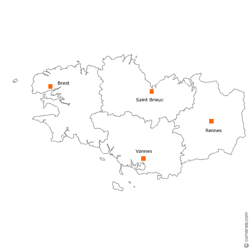
Supermarchés, Hypermarchés en région Bretagne
1 123 supermarchés sont référencés sur la région Bretagne
Vous recherchez un supermarché ou un hyper en Bretagne ?
La région Bretagne représente 6% des supermarchés de France.
C'est le département d'Ille-et-Vilaine qui compte le plus de supermarchés en Bretagne.
C'est le département d'Ille-et-Vilaine qui compte le plus de supermarchés en Bretagne.
Supermarchés, Hypermarchés en Ille-et-Vilaine (35)
Secteur de Rennes
Indice d'implantation
| Commune | Nb Pro | Habitants | Distance | |
|---|---|---|---|---|
| Rennes - 35000 | 57 | 211373 | 0,0 | km |
Secteur de Saint-Malo
Indice d'implantation
| Commune | Nb Pro | Habitants | Distance | |
|---|---|---|---|---|
| Saint-Malo - 35400 | 29 | 44919 | 0,0 | km |
| Saint-Jouan-des-Guérets - 35430 | 1 | 2569 | 4,9 | km |
| la Gouesnière - 35350 | 1 | 1718 | 9,2 | km |
| Cancale - 35260 | 4 | 5208 | 12,8 | km |
| Miniac-Morvan - 35540 | 2 | 3783 | 15,8 | km |
| Plerguer - 35540 | 2 | 2497 | 16,9 | km |
Secteur de Bruz
Indice d'implantation
| Commune | Nb Pro | Habitants | Distance | |
|---|---|---|---|---|
| Bruz - 35170 | 4 | 16855 | 0,0 | km |
| Pont-Péan - 35131 | 1 | 3905 | 3,5 | km |
| Chartres-de-Bretagne - 35131 | 1 | 7395 | 3,8 | km |
| Chavagne - 35310 | 2 | 3681 | 4,5 | km |
| Laillé - 35890 | 3 | 4951 | 5,4 | km |
| Saint-Jacques-de-la-Lande - 35136 | 5 | 11783 | 5,4 | km |
| Orgères - 35230 | 4 | 4102 | 6,5 | km |
| Noyal-Châtillon-sur-Seiche - 35230 | 1 | 6783 | 6,6 | km |
| le Rheu - 35650 | 4 | 7940 | 6,6 | km |
| Mordelles - 35310 | 1 | 7168 | 9,3 | km |
| Bourgbarré - 35230 | 1 | 3737 | 10,2 | km |
| Vezin-le-Coquet - 35132 | 2 | 4901 | 10,6 | km |
| l'Hermitage - 35590 | 2 | 4042 | 12,5 | km |
| Corps-Nuds - 35150 | 2 | 3176 | 12,9 | km |
| la Chapelle-Thouarault - 35590 | 1 | 1945 | 14,3 | km |
| Saint-Gilles - 35590 | 1 | 4125 | 15,7 | km |
| Romillé - 35850 | 1 | 3762 | 23,9 | km |
Secteur de Vitré
Indice d'implantation
| Commune | Nb Pro | Habitants | Distance | |
|---|---|---|---|---|
| Vitré - 35500 | 8 | 17463 | 0,0 | km |
| Étrelles - 35370 | 1 | 2577 | 7,5 | km |
| Val-d'Izé - 35450 | 2 | 2547 | 8,7 | km |
| Argentré-du-Plessis - 35370 | 9 | 4273 | 9,0 | km |
| Bais - 35680 | 1 | 2235 | 14,2 | km |
| Châteaubourg - 35220 | 5 | 6513 | 14,4 | km |
| Domagné - 35113 | 2 | 2267 | 14,8 | km |
| Availles-sur-Seiche - 35130 | 1 | 689 | 18,4 | km |
| la Guerche-de-Bretagne - 35130 | 3 | 4277 | 20,4 | km |
Secteur de Cesson-Sévigné
Indice d'implantation
| Commune | Nb Pro | Habitants | Distance | |
|---|---|---|---|---|
| Cesson-Sévigné - 35510 | 5 | 16784 | 0,0 | km |
| Chantepie - 35135 | 1 | 10410 | 3,6 | km |
| Thorigné-Fouillard - 35235 | 2 | 7770 | 4,4 | km |
| Acigné - 35690 | 1 | 6282 | 5,3 | km |
| Saint-Grégoire - 35760 | 3 | 8989 | 6,8 | km |
| Betton - 35830 | 3 | 10608 | 7,7 | km |
| Vern-sur-Seiche - 35770 | 3 | 7957 | 8,0 | km |
| Montgermont - 35760 | 1 | 3243 | 9,2 | km |
| Brécé - 35530 | 1 | 2051 | 9,3 | km |
| la Chapelle-des-Fougeretz - 35520 | 2 | 4673 | 11,4 | km |
| Pacé - 35740 | 3 | 11044 | 12,8 | km |
| Bécherel - 35190 | 4 | 722 | 32,0 | km |
Secteur de Combourg
Indice d'implantation
| Commune | Nb Pro | Habitants | Distance | |
|---|---|---|---|---|
| Combourg - 35270 | 5 | 5765 | 0,0 | km |
| Saint-Domineuc - 35190 | 2 | 2472 | 10,1 | km |
| Tinténiac - 35190 | 2 | 3372 | 10,8 | km |
| Saint-Pierre-de-Plesguen - 35720 | 4 | 4 | 12,8 | km |
| Hédé - 35630 | 2 | 2099 | 13,4 | km |
| Dol-de-Bretagne - 35120 | 6 | 5469 | 15,5 | km |
| Pleine-Fougères - 35610 | 1 | 1960 | 19,6 | km |
| Antrain - 35560 | 4 | 4 | 20,7 | km |
Secteur de Montfort-sur-Meu
Indice d'implantation
| Commune | Nb Pro | Habitants | Distance | |
|---|---|---|---|---|
| Montfort-sur-Meu - 35160 | 3 | 6483 | 0,0 | km |
| Breteil - 35160 | 1 | 3460 | 4,2 | km |
| Bédée - 35137 | 2 | 4058 | 4,6 | km |
| Pleumeleuc - 35137 | 1 | 3132 | 5,9 | km |
| Iffendic - 35750 | 1 | 4454 | 6,0 | km |
| Montauban-de-Bretagne - 35360 | 2 | 5 | 9,9 | km |
| Irodouër - 35850 | 1 | 2169 | 12,5 | km |
| Saint-Méen-le-Grand - 35290 | 5 | 4541 | 18,3 | km |
| Plélan-le-Grand - 35380 | 3 | 3691 | 18,5 | km |
| Quédillac - 35290 | 1 | 1185 | 18,7 | km |
Secteur de Fougères
Indice d'implantation
| Commune | Nb Pro | Habitants | Distance | |
|---|---|---|---|---|
| Fougères - 35133 | 9 | 20170 | 0,0 | km |
| Lécousse - 35133 | 3 | 3058 | 2,0 | km |
| Saint-Germain-en-Coglès - 35133 | 1 | 2024 | 7,5 | km |
| Billé - 35133 | 1 | 1038 | 7,9 | km |
| Saint-Brice-en-Coglès - 35460 | 1 | 2944 | 13,8 | km |
| Louvigné-du-Désert - 35420 | 3 | 3435 | 15,5 | km |
Secteur de Redon
Indice d'implantation
| Commune | Nb Pro | Habitants | Distance | |
|---|---|---|---|---|
| Redon - 35600 | 3 | 9114 | 0,0 | km |
| Saint-Nicolas-de-Redon - 44460 | 3 | 3150 | 1,6 | km |
| Rieux - 56350 | 1 | 2878 | 6,5 | km |
| Allaire - 56350 | 2 | 3727 | 6,7 | km |
| Peillac - 56220 | 2 | 1859 | 12,1 | km |
| Guémené-Penfao - 44290 | 1 | 5248 | 18,8 | km |
| Plessé - 44630 | 2 | 5017 | 19,2 | km |
| Pipriac - 35550 | 1 | 3672 | 19,8 | km |
| Pierric - 44290 | 2 | 976 | 26,2 | km |
Secteur de Dinard
Indice d'implantation
| Commune | Nb Pro | Habitants | Distance | |
|---|---|---|---|---|
| Dinard - 35800 | 3 | 9839 | 0,0 | km |
| Saint-Lunaire - 35800 | 1 | 2287 | 3,4 | km |
| la Richardais - 35780 | 2 | 2312 | 3,6 | km |
| Saint-Briac-sur-Mer - 35800 | 2 | 1965 | 5,4 | km |
| Pleurtuit - 35730 | 3 | 6399 | 6,2 | km |
| Ploubalay - 22650 | 3 | 3014 | 8,2 | km |
Secteur de Melesse
Indice d'implantation
| Commune | Nb Pro | Habitants | Distance | |
|---|---|---|---|---|
| Melesse - 35520 | 1 | 5913 | 0,0 | km |
| la Mézière - 35520 | 2 | 4510 | 4,3 | km |
| Montreuil-sur-Ille - 35440 | 3 | 2209 | 10,3 | km |
| Sens-de-Bretagne - 35490 | 3 | 2559 | 17,5 | km |
| Vieux-Vy-sur-Couesnon - 35490 | 1 | 1131 | 20,8 | km |
Secteur de Bain-de-Bretagne
Indice d'implantation
| Commune | Nb Pro | Habitants | Distance | |
|---|---|---|---|---|
| Bain-de-Bretagne - 35470 | 3 | 7512 | 0,0 | km |
| Tresbœuf - 35320 | 1 | 1246 | 9,5 | km |
| Crevin - 35320 | 2 | 2588 | 10,8 | km |
| Grand-Fougeray - 35390 | 3 | 2417 | 13,6 | km |
Secteur de Guichen
Indice d'implantation
| Commune | Nb Pro | Habitants | Distance | |
|---|---|---|---|---|
| Guichen - 35580 | 2 | 8095 | 0,0 | km |
| Goven - 35580 | 1 | 4417 | 5,6 | km |
| Bourg-des-Comptes - 35890 | 2 | 3234 | 6,2 | km |
| Guignen - 35580 | 1 | 3644 | 7,2 | km |
| Bréal-sous-Montfort - 35310 | 2 | 5510 | 10,3 | km |
| Mernel - 35330 | 1 | 1029 | 15,0 | km |
Secteur de Janzé
Indice d'implantation
| Commune | Nb Pro | Habitants | Distance | |
|---|---|---|---|---|
| Janzé - 35150 | 2 | 8232 | 0,0 | km |
| Coësmes - 35134 | 1 | 1462 | 9,5 | km |
| Retiers - 35240 | 1 | 4088 | 10,1 | km |
| Martigné-Ferchaud - 35640 | 2 | 2619 | 19,6 | km |
Secteur de Liffré
Indice d'implantation
| Commune | Nb Pro | Habitants | Distance | |
|---|---|---|---|---|
| Liffré - 35340 | 2 | 7164 | 0,0 | km |
| la Bouëxière - 35340 | 1 | 4121 | 6,1 | km |
| Saint-Aubin-du-Cormier - 35140 | 1 | 3601 | 9,6 | km |
Secteur de Châteaugiron
Indice d'implantation
| Commune | Nb Pro | Habitants | Distance | |
|---|---|---|---|---|
| Châteaugiron - 35410 | 1 | 7204 | 0,0 | km |
| Domloup - 35410 | 1 | 2879 | 2,2 | km |
| Noyal-sur-Vilaine - 35530 | 2 | 5590 | 7,7 | km |
Supermarchés, Hypermarchés dans les Côtes d'Armor (22)
Secteur de Saint-Brieuc
Indice d'implantation
| Commune | Nb Pro | Habitants | Distance | |
|---|---|---|---|---|
| Saint-Brieuc - 22000 | 12 | 45331 | 0,0 | km |
| Plérin - 22190 | 7 | 14394 | 2,4 | km |
| Ploufragan - 22440 | 3 | 11569 | 3,3 | km |
| Trégueux - 22950 | 4 | 8172 | 3,9 | km |
| Langueux - 22360 | 3 | 7427 | 4,9 | km |
| Trémuson - 22440 | 1 | 1981 | 5,6 | km |
| Pordic - 22590 | 6 | 6885 | 7,1 | km |
| Saint-Julien - 22940 | 3 | 2063 | 7,6 | km |
| Yffiniac - 22120 | 2 | 4903 | 7,9 | km |
| Plédran - 22960 | 2 | 6346 | 8,0 | km |
| Plaintel - 22940 | 2 | 4246 | 12,4 | km |
| Étables-sur-Mer - 22680 | 1 | 3022 | 13,4 | km |
| Plourhan - 22410 | 1 | 1984 | 14,7 | km |
| Saint-Brandan - 22800 | 1 | 2386 | 15,6 | km |
| Quintin - 22800 | 1 | 2822 | 15,9 | km |
| Saint-Quay-Portrieux - 22410 | 2 | 2995 | 16,1 | km |
| Plœuc-sur-Lié - 22150 | 2 | 4058 | 18,6 | km |
Secteur de Lannion
Indice d'implantation
| Commune | Nb Pro | Habitants | Distance | |
|---|---|---|---|---|
| Lannion - 22300 | 11 | 19627 | 0,0 | km |
| Ploubezre - 22300 | 1 | 3608 | 3,3 | km |
| Ploulec'h - 22300 | 2 | 1671 | 3,8 | km |
| Saint-Quay-Perros - 22700 | 2 | 1364 | 6,1 | km |
| Pleumeur-Bodou - 22560 | 2 | 3983 | 6,2 | km |
| Louannec - 22700 | 1 | 3022 | 7,4 | km |
| Trébeurden - 22560 | 1 | 3627 | 8,8 | km |
| Perros-Guirec - 22700 | 7 | 7312 | 8,8 | km |
| Trégastel - 22730 | 3 | 2425 | 8,9 | km |
| Penvénan - 22710 | 1 | 2609 | 14,6 | km |
| Plestin-les-Grèves - 22310 | 1 | 3640 | 15,3 | km |
| Minihy-Tréguier - 22220 | 1 | 1275 | 17,5 | km |
| Tréguier - 22220 | 1 | 2489 | 17,6 | km |
| Lézardrieux - 22740 | 1 | 1612 | 26,3 | km |
| Pleubian - 22610 | 5 | 2447 | 26,3 | km |
Secteur de Dinan
Indice d'implantation
| Commune | Nb Pro | Habitants | Distance | |
|---|---|---|---|---|
| Dinan - 22100 | 4 | 10940 | 0,0 | km |
| Lanvallay - 22100 | 5 | 3903 | 1,6 | km |
| Quévert - 22100 | 1 | 3751 | 3,3 | km |
| Taden - 22100 | 2 | 2288 | 3,4 | km |
| Trélivan - 22100 | 1 | 2574 | 5,8 | km |
| Plouër-sur-Rance - 22490 | 1 | 3409 | 9,0 | km |
| Évran - 22630 | 1 | 1742 | 9,3 | km |
| Plélan-le-Petit - 22980 | 1 | 1836 | 12,7 | km |
| Plancoët - 22130 | 1 | 3061 | 15,9 | km |
| Saint-Jacut-de-la-Mer - 22750 | 1 | 867 | 19,5 | km |
| Caulnes - 22350 | 1 | 2448 | 19,8 | km |
| Broons - 22250 | 3 | 2958 | 21,8 | km |
| Matignon - 22550 | 3 | 1633 | 23,9 | km |
| Saint-Cast-le-Guildo - 22380 | 3 | 3449 | 24,6 | km |
Secteur de Paimpol
Indice d'implantation
| Commune | Nb Pro | Habitants | Distance | |
|---|---|---|---|---|
| Callac - 22160 | 1 | 2236 | 0,0 | km |
| Paimpol - 22500 | 9 | 7298 | 0,0 | km |
| Ploubazlanec - 22620 | 1 | 3057 | 2,5 | km |
| Plouézec - 22470 | 2 | 3259 | 5,7 | km |
| Pontrieux - 22260 | 2 | 1021 | 12,4 | km |
| Saint-Agathon - 22200 | 1 | 2197 | 24,9 | km |
| Bégard - 22140 | 4 | 4786 | 25,1 | km |
| Guingamp - 22200 | 3 | 7106 | 25,4 | km |
| Ploumagoar - 22970 | 1 | 5294 | 26,7 | km |
| Grâces - 22200 | 1 | 2482 | 26,8 | km |
| Louargat - 22540 | 1 | 2329 | 32,2 | km |
| Bourbriac - 22390 | 1 | 2339 | 35,3 | km |
| Belle-Isle-en-Terre - 22810 | 1 | 1102 | 36,7 | km |
Secteur de Loudéac
Indice d'implantation
| Commune | Nb Pro | Habitants | Distance | |
|---|---|---|---|---|
| Loudéac - 22600 | 8 | 9711 | 0,0 | km |
| la Chèze - 22210 | 1 | 576 | 8,9 | km |
| Plémet - 22210 | 1 | 3670 | 12,0 | km |
| Plouguenast - 22150 | 1 | 2 | 12,2 | km |
| Uzel - 22460 | 2 | 1122 | 13,0 | km |
| Mûr-de-Bretagne - 22530 | 1 | 2078 | 17,4 | km |
| Collinée - 22330 | 2 | 6431 | 22,3 | km |
| Merdrignac - 22230 | 1 | 2906 | 25,4 | km |
| Corlay - 22320 | 3 | 982 | 27,4 | km |
| Saint-Nicolas-du-Pélem - 22480 | 1 | 1706 | 33,7 | km |
| Rostrenen - 22110 | 2 | 3224 | 42,2 | km |
Secteur de Pléneuf-Val-André
Indice d'implantation
| Commune | Nb Pro | Habitants | Distance | |
|---|---|---|---|---|
| Pléneuf-Val-André - 22370 | 6 | 4031 | 0,0 | km |
| Erquy - 22430 | 2 | 3895 | 7,7 | km |
| Plurien - 22240 | 1 | 1465 | 11,1 | km |
| Hénanbihen - 22550 | 4 | 1393 | 12,6 | km |
| Lamballe - 22400 | 4 | 16 | 13,3 | km |
| Quessoy - 22120 | 1 | 3830 | 20,2 | km |
| Moncontour - 22510 | 1 | 914 | 26,1 | km |
| Plénée-Jugon - 22640 | 2 | 2423 | 26,7 | km |
Secteur de Plouha
Indice d'implantation
| Commune | Nb Pro | Habitants | Distance | |
|---|---|---|---|---|
| Plouha - 22580 | 3 | 4505 | 0,0 | km |
| Lanvollon - 22290 | 2 | 1749 | 6,5 | km |
| Goudelin - 22290 | 1 | 1701 | 10,3 | km |
| Pommerit-le-Vicomte - 22200 | 3 | 1824 | 13,3 | km |
| Plouagat - 22170 | 1 | 3 | 16,4 | km |
Supermarchés, Hypermarchés dans le Morbihan (56)
Secteur de Lorient
Indice d'implantation
| Commune | Nb Pro | Habitants | Distance | |
|---|---|---|---|---|
| Lorient - 56100 | 32 | 57961 | 0,0 | km |
| Locmiquélic - 56570 | 3 | 4141 | 3,0 | km |
| Larmor-Plage - 56260 | 3 | 8204 | 4,4 | km |
| Ploemeur - 56270 | 4 | 18039 | 4,8 | km |
| Gâvres - 56680 | 2 | 704 | 6,2 | km |
| Guidel - 56520 | 4 | 10760 | 10,6 | km |
| Groix - 56590 | 2 | 2233 | 13,5 | km |
Secteur de Vannes
Indice d'implantation
| Commune | Nb Pro | Habitants | Distance | |
|---|---|---|---|---|
| Vannes - 56000 | 22 | 53032 | 0,0 | km |
| Séné - 56860 | 3 | 8821 | 4,4 | km |
| Arradon - 56610 | 1 | 5514 | 5,5 | km |
| Ploeren - 56880 | 2 | 6284 | 8,1 | km |
| le Hézo - 56450 | 1 | 759 | 8,8 | km |
| Île-aux-Moines - 56780 | 1 | 611 | 10,0 | km |
| Baden - 56870 | 2 | 4346 | 12,4 | km |
| Surzur - 56450 | 1 | 4078 | 13,1 | km |
| la Trinité-Surzur - 56190 | 1 | 1442 | 14,1 | km |
| Bono - 56400 | 1 | 2111 | 14,1 | km |
| Sarzeau - 56370 | 6 | 7756 | 14,3 | km |
| Arzon - 56640 | 2 | 2108 | 15,3 | km |
| le Tour-du-Parc - 56370 | 4 | 1197 | 16,8 | km |
| Saint-Gildas-de-Rhuys - 56730 | 1 | 1685 | 18,1 | km |
Secteur d'Auray
Indice d'implantation
| Commune | Nb Pro | Habitants | Distance | |
|---|---|---|---|---|
| Auray - 56400 | 8 | 12946 | 0,0 | km |
| Pluneret - 56400 | 1 | 5304 | 2,5 | km |
| Saint-Philibert - 56470 | 1 | 1594 | 9,4 | km |
| la Trinité-sur-Mer - 56470 | 1 | 1642 | 9,8 | km |
| Locoal-Mendon - 56550 | 2 | 3279 | 9,8 | km |
| Carnac - 56340 | 2 | 4183 | 11,7 | km |
| Pluvigner - 56330 | 1 | 7346 | 11,9 | km |
| Locmariaquer - 56740 | 2 | 1581 | 12,1 | km |
| Plouharnel - 56340 | 1 | 2133 | 12,2 | km |
| Erdeven - 56410 | 2 | 3522 | 12,9 | km |
| Belz - 56550 | 1 | 3580 | 13,3 | km |
| Landévant - 56690 | 1 | 3482 | 14,4 | km |
| Étel - 56410 | 5 | 1994 | 15,8 | km |
| Saint-Pierre-Quiberon - 56510 | 1 | 2116 | 19,8 | km |
| Quiberon - 56170 | 5 | 4987 | 23,0 | km |
| Sauzon - 56360 | 1 | 908 | 37,5 | km |
| le Palais - 56360 | 1 | 2580 | 38,2 | km |
Secteur de Lanester
Indice d'implantation
| Commune | Nb Pro | Habitants | Distance | |
|---|---|---|---|---|
| Lanester - 56600 | 5 | 21874 | 0,0 | km |
| Caudan - 56850 | 2 | 6747 | 5,2 | km |
| Quéven - 56530 | 1 | 8677 | 6,0 | km |
| Riantec - 56670 | 2 | 5232 | 6,5 | km |
| Hennebont - 56700 | 6 | 15765 | 6,6 | km |
| Gestel - 56530 | 1 | 2701 | 8,6 | km |
| Inzinzac-Lochrist - 56650 | 2 | 6365 | 10,4 | km |
| Cléguer - 56620 | 3 | 3319 | 10,4 | km |
| Languidic - 56440 | 1 | 7562 | 16,0 | km |
| Plouay - 56240 | 5 | 5385 | 16,6 | km |
| Bubry - 56310 | 1 | 2376 | 25,4 | km |
Secteur de Saint-Avé
Indice d'implantation
| Commune | Nb Pro | Habitants | Distance | |
|---|---|---|---|---|
| Saint-Avé - 56890 | 5 | 10728 | 0,0 | km |
| Plescop - 56890 | 5 | 5369 | 5,1 | km |
| Saint-Nolff - 56250 | 1 | 3665 | 6,7 | km |
| Plaudren - 56420 | 1 | 1755 | 10,4 | km |
| Grand-Champ - 56390 | 2 | 5165 | 11,0 | km |
| Elven - 56250 | 5 | 5609 | 12,1 | km |
| Sulniac - 56250 | 1 | 3382 | 12,7 | km |
Secteur de Muzillac
Indice d'implantation
| Commune | Nb Pro | Habitants | Distance | |
|---|---|---|---|---|
| Muzillac - 56190 | 4 | 4869 | 0,0 | km |
| Billiers - 56190 | 1 | 909 | 2,5 | km |
| Noyal-Muzillac - 56190 | 2 | 2530 | 4,6 | km |
| Ambon - 56190 | 4 | 1794 | 5,8 | km |
| Damgan - 56750 | 3 | 1656 | 8,4 | km |
| la Roche-Bernard - 56130 | 2 | 658 | 14,2 | km |
| Nivillac - 56130 | 4 | 4364 | 15,0 | km |
Secteur de Pontivy
Indice d'implantation
| Commune | Nb Pro | Habitants | Distance | |
|---|---|---|---|---|
| Pontivy - 56300 | 9 | 13915 | 0,0 | km |
| Saint-Thuriau - 56300 | 2 | 1849 | 6,0 | km |
| Noyal-Pontivy - 56920 | 1 | 3677 | 6,7 | km |
| Cléguérec - 56480 | 1 | 2912 | 9,6 | km |
| Rohan - 56580 | 1 | 1684 | 16,1 | km |
| Réguiny - 56500 | 1 | 1896 | 19,6 | km |
| Bréhan - 56580 | 2 | 2330 | 21,1 | km |
| Pleugriffet - 56120 | 1 | 1186 | 22,9 | km |
Secteur de Mauron
Indice d'implantation
| Commune | Nb Pro | Habitants | Distance | |
|---|---|---|---|---|
| Mauron - 56430 | 4 | 3291 | 0,0 | km |
| Guilliers - 56490 | 2 | 1396 | 9,7 | km |
| Mohon - 56490 | 1 | 1008 | 17,9 | km |
| Ploërmel - 56800 | 6 | 9 | 18,7 | km |
| Josselin - 56120 | 2 | 2471 | 24,0 | km |
| Guégon - 56120 | 2 | 2318 | 26,2 | km |
Secteur de Guer
Indice d'implantation
| Commune | Nb Pro | Habitants | Distance | |
|---|---|---|---|---|
| Guer - 56380 | 3 | 6310 | 0,0 | km |
| Beignon - 56380 | 1 | 1836 | 8,4 | km |
| Carentoir - 56910 | 1 | 2721 | 9,7 | km |
| Augan - 56800 | 1 | 1551 | 11,7 | km |
| la Gacilly - 56200 | 2 | 2205 | 15,3 | km |
| Malestroit - 56140 | 4 | 2476 | 22,3 | km |
| Saint-Marcel - 56140 | 1 | 1052 | 24,8 | km |
| Sérent - 56460 | 1 | 3064 | 30,1 | km |
Secteur de Gourin
Indice d'implantation
| Commune | Nb Pro | Habitants | Distance | |
|---|---|---|---|---|
| Gourin - 56110 | 2 | 4079 | 0,0 | km |
| Guiscriff - 56560 | 1 | 2301 | 10,4 | km |
| le Faouët - 56320 | 5 | 2822 | 14,9 | km |
| Meslan - 56320 | 1 | 1410 | 21,0 | km |
| Guémené-sur-Scorff - 56160 | 5 | 1131 | 30,8 | km |
Secteur de Baud
Indice d'implantation
| Commune | Nb Pro | Habitants | Distance | |
|---|---|---|---|---|
| Baud - 56150 | 3 | 6126 | 0,0 | km |
| Pluméliau - 56930 | 3 | 4 | 9,6 | km |
| Locminé - 56500 | 3 | 4116 | 13,8 | km |
| Moréac - 56500 | 1 | 3846 | 15,7 | km |
| Bignan - 56500 | 2 | 2770 | 18,6 | km |
| Saint-Jean-Brévelay - 56660 | 1 | 2765 | 22,6 | km |
Secteur de Questembert
Indice d'implantation
| Commune | Nb Pro | Habitants | Distance | |
|---|---|---|---|---|
| Questembert - 56230 | 5 | 7424 | 0,0 | km |
| Malansac - 56220 | 1 | 2140 | 11,9 | km |
Secteur de Kervignac
Indice d'implantation
| Commune | Nb Pro | Habitants | Distance | |
|---|---|---|---|---|
| Kervignac - 56700 | 2 | 6489 | 0,0 | km |
| Merlevenez - 56700 | 2 | 3152 | 3,1 | km |
| Plouhinec - 56680 | 1 | 5291 | 7,5 | km |
Supermarchés, Hypermarchés dans le Finistère (29)
Secteur de Brest
Indice d'implantation
| Commune | Nb Pro | Habitants | Distance | |
|---|---|---|---|---|
| Brest - 29200 | 46 | 139386 | 0,0 | km |
| Guilers - 29820 | 3 | 7886 | 6,5 | km |
| Plouzané - 29280 | 4 | 12175 | 9,6 | km |
Secteur de Quimper
Indice d'implantation
| Commune | Nb Pro | Habitants | Distance | |
|---|---|---|---|---|
| Quimper - 29000 | 23 | 63532 | 0,0 | km |
| Pluguffan - 29700 | 1 | 3847 | 5,3 | km |
| Ergué-Gabéric - 29500 | 2 | 8136 | 6,2 | km |
| Plomelin - 29700 | 5 | 4168 | 7,5 | km |
| Plonéis - 29710 | 1 | 2138 | 7,7 | km |
| Plogonnec - 29180 | 1 | 3057 | 11,0 | km |
| Briec - 29510 | 6 | 5554 | 14,4 | km |
Secteur de Pont-l'Abbé
Indice d'implantation
| Commune | Nb Pro | Habitants | Distance | |
|---|---|---|---|---|
| Pont-l'Abbé - 29120 | 5 | 8304 | 0,0 | km |
| Plobannalec-Lesconil - 29740 | 1 | 3413 | 4,5 | km |
| Tréméoc - 29120 | 1 | 1303 | 4,8 | km |
| Loctudy - 29750 | 3 | 3995 | 5,1 | km |
| Plomeur - 29120 | 4 | 3797 | 5,4 | km |
| Combrit - 29120 | 2 | 3826 | 5,5 | km |
| Guilvinec - 29730 | 5 | 2860 | 8,8 | km |
| Penmarch - 29760 | 3 | 5401 | 10,4 | km |
Secteur de Quimperlé
Indice d'implantation
| Commune | Nb Pro | Habitants | Distance | |
|---|---|---|---|---|
| Quimperlé - 29300 | 4 | 11978 | 0,0 | km |
| Tréméven - 29300 | 2 | 2279 | 3,2 | km |
| Mellac - 29300 | 2 | 2833 | 4,1 | km |
| Clohars-Carnoët - 29360 | 3 | 4176 | 8,7 | km |
| Moëlan-sur-Mer - 29350 | 6 | 7033 | 8,9 | km |
| Riec-sur-Belon - 29340 | 1 | 4111 | 11,3 | km |
| Bannalec - 29380 | 1 | 5569 | 12,9 | km |
| Scaër - 29390 | 4 | 5361 | 20,8 | km |
Secteur de Concarneau
Indice d'implantation
| Commune | Nb Pro | Habitants | Distance | |
|---|---|---|---|---|
| Concarneau - 29900 | 6 | 18867 | 0,0 | km |
| Trégunc - 29910 | 4 | 7056 | 5,7 | km |
| Rosporden - 29140 | 5 | 7507 | 11,4 | km |
| Névez - 29920 | 1 | 2682 | 11,5 | km |
| Pont-Aven - 29930 | 2 | 2842 | 13,3 | km |
| Elliant - 29370 | 1 | 3199 | 13,7 | km |
| Coray - 29370 | 1 | 1904 | 21,8 | km |
Secteur de Plabennec
Indice d'implantation
| Commune | Nb Pro | Habitants | Distance | |
|---|---|---|---|---|
| Plabennec - 29860 | 5 | 8276 | 0,0 | km |
| Kersaint-Plabennec - 29860 | 2 | 1357 | 5,2 | km |
| Bourg-Blanc - 29860 | 1 | 3447 | 5,7 | km |
| Lannilis - 29870 | 2 | 5378 | 10,3 | km |
| Plouguerneau - 29880 | 6 | 6411 | 13,1 | km |
| Saint-Pabu - 29830 | 1 | 2060 | 14,2 | km |
Secteur de Carhaix-Plouguer
Indice d'implantation
| Commune | Nb Pro | Habitants | Distance | |
|---|---|---|---|---|
| Carhaix-Plouguer - 29270 | 6 | 7397 | 0,0 | km |
| Kergloff - 29270 | 1 | 937 | 3,6 | km |
| Huelgoat - 29690 | 3 | 1542 | 16,0 | km |
| Plonévez-du-Faou - 29530 | 2 | 2147 | 18,9 | km |
| Châteauneuf-du-Faou - 29520 | 5 | 3717 | 20,4 | km |
Secteur de Morlaix
Indice d'implantation
| Commune | Nb Pro | Habitants | Distance | |
|---|---|---|---|---|
| Morlaix - 29600 | 6 | 15264 | 0,0 | km |
| Saint-Martin-des-Champs - 29600 | 3 | 4731 | 0,9 | km |
| Taulé - 29670 | 1 | 2985 | 5,8 | km |
| Pleyber-Christ - 29410 | 1 | 3083 | 9,0 | km |
| Lanmeur - 29620 | 1 | 2193 | 11,2 | km |
| Plougasnou - 29630 | 1 | 3108 | 13,0 | km |
| Guimaëc - 29620 | 1 | 974 | 13,2 | km |
| Guerlesquin - 29650 | 1 | 1355 | 19,3 | km |
Secteur de Guipavas
Indice d'implantation
| Commune | Nb Pro | Habitants | Distance | |
|---|---|---|---|---|
| Guipavas - 29490 | 1 | 13966 | 0,0 | km |
| le Relecq-Kerhuon - 29480 | 3 | 11323 | 3,6 | km |
| Gouesnou - 29850 | 6 | 5845 | 5,2 | km |
| Plougastel-Daoulas - 29470 | 3 | 13101 | 7,3 | km |
Secteur de Douarnenez
Indice d'implantation
| Commune | Nb Pro | Habitants | Distance | |
|---|---|---|---|---|
| Douarnenez - 29100 | 7 | 14750 | 0,0 | km |
| Pont-Croix - 29790 | 1 | 1601 | 13,2 | km |
| Plouhinec - 29780 | 1 | 4106 | 14,5 | km |
| Audierne - 29770 | 2 | 3752 | 17,7 | km |
| Primelin - 29770 | 1 | 729 | 22,3 | km |
Secteur de Fouesnant
Indice d'implantation
| Commune | Nb Pro | Habitants | Distance | |
|---|---|---|---|---|
| Fouesnant - 29170 | 3 | 9305 | 0,0 | km |
| la Forêt-Fouesnant - 29940 | 5 | 3252 | 2,8 | km |
| Saint-Évarzec - 29170 | 1 | 3555 | 4,8 | km |
| Bénodet - 29950 | 2 | 3442 | 7,8 | km |
Secteur de Châteaulin
Indice d'implantation
| Commune | Nb Pro | Habitants | Distance | |
|---|---|---|---|---|
| Châteaulin - 29150 | 3 | 5177 | 0,0 | km |
| Dinéault - 29150 | 2 | 1885 | 6,1 | km |
| Pleyben - 29190 | 1 | 3710 | 9,7 | km |
| Plomodiern - 29550 | 4 | 2148 | 10,4 | km |
Secteur de Crozon
Indice d'implantation
| Commune | Nb Pro | Habitants | Distance | |
|---|---|---|---|---|
| Crozon - 29160 | 5 | 7634 | 0,0 | km |
| Camaret-sur-Mer - 29570 | 2 | 2586 | 8,5 | km |
| Telgruc-sur-Mer - 29560 | 1 | 2120 | 10,0 | km |
| le Faou - 29590 | 1 | 1725 | 23,6 | km |
| Pont-de-Buis-lès-Quimerch - 29590 | 1 | 3856 | 28,7 | km |
Secteur de Saint-Pol-de-Léon
Indice d'implantation
| Commune | Nb Pro | Habitants | Distance | |
|---|---|---|---|---|
| Saint-Pol-de-Léon - 29250 | 4 | 6618 | 0,0 | km |
| Santec - 29250 | 1 | 2335 | 3,3 | km |
| Plouénan - 29420 | 1 | 2517 | 6,3 | km |
| Cléder - 29233 | 1 | 3833 | 8,6 | km |
| Plouescat - 29430 | 2 | 3557 | 13,9 | km |
Secteur de Saint-Renan
Indice d'implantation
| Commune | Nb Pro | Habitants | Distance | |
|---|---|---|---|---|
| Saint-Renan - 29290 | 1 | 7815 | 0,0 | km |
| Plouarzel - 29810 | 2 | 3713 | 7,9 | km |
| Ploumoguer - 29810 | 1 | 1941 | 8,0 | km |
| Plougonvelin - 29217 | 2 | 3946 | 12,3 | km |
| Ploudalmézeau - 29830 | 2 | 6263 | 12,6 | km |
Secteur de Landerneau
Indice d'implantation
| Commune | Nb Pro | Habitants | Distance | |
|---|---|---|---|---|
| Landerneau - 29800 | 6 | 15443 | 0,0 | km |
| Daoulas - 29460 | 1 | 1768 | 10,1 | km |
Secteur de Landivisiau
Indice d'implantation
| Commune | Nb Pro | Habitants | Distance | |
|---|---|---|---|---|
| Landivisiau - 29400 | 4 | 9108 | 0,0 | km |
| Plougourvest - 29400 | 1 | 1392 | 4,9 | km |
| Plouzévédé - 29440 | 1 | 1793 | 10,0 | km |
Secteur de Plonéour-Lanvern
Indice d'implantation
| Commune | Nb Pro | Habitants | Distance | |
|---|---|---|---|---|
| Plonéour-Lanvern - 29720 | 0 | 6014 | 0,0 | km |
| Pouldreuzic - 29710 | 1 | 2132 | 8,2 | km |
| Landudec - 29710 | 1 | 1360 | 11,7 | km |
| Plozévet - 29710 | 1 | 2959 | 14,1 | km |
Secteur de Lesneven
Indice d'implantation
| Commune | Nb Pro | Habitants | Distance | |
|---|---|---|---|---|
| Lesneven - 29260 | 1 | 7229 | 0,0 | km |
| le Folgoët - 29260 | 1 | 3142 | 1,7 | km |
| Kerlouan - 29890 | 1 | 2254 | 8,8 | km |