
Supermarchés, Hypermarchés en région Pays-de-la-Loire
974 supermarchés sont référencés sur la région Pays-de-la-Loire
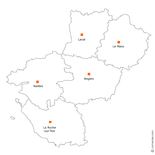
Vous recherchez un supermarché ou un hyper dans les Pays-de-la-Loire ?
La région Pays-de-la-Loire représente 6% des supermarchés de France.
C'est le département de Loire-Atlantique qui compte le plus de supermarchés dans les Pays-de-la-Loire.
C'est le département de Loire-Atlantique qui compte le plus de supermarchés dans les Pays-de-la-Loire.
Supermarchés, Hypermarchés dans le Maine-et-Loire (49)
Secteur d'Angers
Indice d'implantation
| Commune | Nb Pro | Habitants | Distance | |
|---|---|---|---|---|
| Angers - 49000 | 37 | 150125 | 0,0 | km |
| Avrillé - 49240 | 4 | 12972 | 4,8 | km |
| Beaucouzé - 49070 | 2 | 4935 | 5,8 | km |
| Écouflant - 49000 | 2 | 3798 | 6,8 | km |
| Cantenay-Épinard - 49460 | 1 | 2044 | 7,0 | km |
| Montreuil-Juigné - 49460 | 1 | 7213 | 7,7 | km |
| Mûrs-Erigné - 49610 | 3 | 5368 | 8,3 | km |
Secteur de Cholet
Indice d'implantation
| Commune | Nb Pro | Habitants | Distance | |
|---|---|---|---|---|
| Cholet - 49300 | 23 | 53890 | 0,0 | km |
| Saint-Léger-sous-Cholet - 49280 | 1 | 2609 | 4,6 | km |
| la Tessoualle - 49280 | 1 | 3076 | 6,4 | km |
| le May-sur-Èvre - 49122 | 2 | 3953 | 8,6 | km |
| la Romagne - 49740 | 1 | 1782 | 11,1 | km |
| Maulévrier - 49360 | 1 | 3179 | 11,4 | km |
| Vihiers - 49310 | 6 | 7882 | 27,7 | km |
Secteur de Saumur
Indice d'implantation
| Commune | Nb Pro | Habitants | Distance | |
|---|---|---|---|---|
| Saumur - 49400 | 10 | 27413 | 0,0 | km |
| Distré - 49400 | 3 | 1684 | 4,7 | km |
| Chacé - 49400 | 1 | 3 | 4,8 | km |
| Allonnes - 49650 | 1 | 2980 | 8,6 | km |
| Varennes-sur-Loire - 49730 | 2 | 1891 | 10,1 | km |
| Saint-Clément-des-Levées - 49350 | 1 | 1157 | 11,5 | km |
| Brain-sur-Allonnes - 49650 | 1 | 1987 | 12,0 | km |
| Longué-Jumelles - 49160 | 3 | 6875 | 13,8 | km |
| Montreuil-Bellay - 49260 | 2 | 4030 | 14,9 | km |
| les Rosiers-sur-Loire - 49350 | 2 | 2327 | 15,4 | km |
| Doué-la-Fontaine - 49700 | 4 | 7584 | 16,2 | km |
| Vernantes - 49390 | 1 | 1975 | 18,0 | km |
Secteur de Loire-Authion
Indice d'implantation
| Commune | Nb Pro | Habitants | Distance | |
|---|---|---|---|---|
| Saint-Mathurin-sur-Loire - 49250 | 0 | 15471 | 0,0 | km |
| Sarrigné - 49800 | 2 | 819 | 11,3 | km |
| Trélazé - 49800 | 4 | 13125 | 11,9 | km |
| Saint-Barthélemy-d'Anjou - 49124 | 4 | 9077 | 14,7 | km |
| les Ponts-de-Cé - 49130 | 1 | 12112 | 15,4 | km |
| Saint-Sylvain-d'Anjou - 49480 | 1 | 6973 | 16,8 | km |
| Sainte-Gemmes-sur-Loire - 49130 | 1 | 3521 | 18,1 | km |
| Saint-Martin-du-Fouilloux - 49170 | 1 | 1672 | 29,1 | km |
Secteur de Chalonnes-sur-Loire
Indice d'implantation
| Commune | Nb Pro | Habitants | Distance | |
|---|---|---|---|---|
| Chalonnes-sur-Loire - 49290 | 3 | 6528 | 0,0 | km |
| Saint-Georges-sur-Loire - 49170 | 1 | 3529 | 6,1 | km |
| la Possonnière - 49170 | 1 | 2416 | 6,5 | km |
| Champtocé-sur-Loire - 49123 | 1 | 1866 | 9,9 | km |
| Mozé-sur-Louet - 49610 | 1 | 2045 | 16,2 | km |
| Thouarcé - 49380 | 2 | 5712 | 22,1 | km |
| Juigné-sur-Loire - 49610 | 2 | 2621 | 22,4 | km |
| Brissac-Quincé - 49320 | 2 | 3059 | 24,2 | km |
Secteur de Sèvremoine
Indice d'implantation
| Commune | Nb Pro | Habitants | Distance | |
|---|---|---|---|---|
| Saint-Macaire-en-Mauges - 49450 | 2 | 24970 | 0,0 | km |
| Beaupréau - 49600 | 4 | 22485 | 8,8 | km |
| Chemillé - 49120 | 4 | 21304 | 22,1 | km |
| la Pommeraye - 49620 | 1 | 18250 | 27,5 | km |
| Champtoceaux - 49270 | 2 | 16025 | 31,5 | km |
Secteur de Baugé-en-Anjou
Indice d'implantation
| Commune | Nb Pro | Habitants | Distance | |
|---|---|---|---|---|
| Baugé - 49150 | 4 | 11873 | 0,0 | km |
| Beaufort-en-Vallée - 49250 | 3 | 7009 | 14,2 | km |
| Mazé - 49630 | 2 | 5578 | 15,7 | km |
| Noyant - 49490 | 1 | 1879 | 17,0 | km |
| Durtal - 49430 | 1 | 3382 | 17,7 | km |
| Corzé - 49140 | 1 | 1718 | 21,4 | km |
Secteur d'Erdre-en-Anjou
Indice d'implantation
| Commune | Nb Pro | Habitants | Distance | |
|---|---|---|---|---|
| Vern-d'Anjou - 49220 | 3 | 5648 | 0,0 | km |
| le Louroux-Béconnais - 49370 | 1 | 3016 | 9,6 | km |
| le Lion-d'Angers - 49220 | 1 | 4465 | 9,7 | km |
| Bécon-les-Granits - 49370 | 1 | 2752 | 11,1 | km |
| Saint-Augustin-des-Bois - 49170 | 1 | 1172 | 16,0 | km |
| Sceaux-d'Anjou - 49330 | 1 | 1132 | 17,3 | km |
| Châteauneuf-sur-Sarthe - 49330 | 3 | 8 | 27,4 | km |
| Tiercé - 49125 | 1 | 4287 | 27,7 | km |
Secteur de Segré-en-Anjou Bleu
Indice d'implantation
| Commune | Nb Pro | Habitants | Distance | |
|---|---|---|---|---|
| Segré - 49500 | 3 | 6925 | 0,0 | km |
| Candé - 49440 | 1 | 2916 | 19,1 | km |
| Pouancé - 49420 | 1 | 3031 | 23,4 | km |
Supermarchés, Hypermarchés dans la Mayenne (53)
Secteur de Laval
Indice d'implantation
| Commune | Nb Pro | Habitants | Distance | |
|---|---|---|---|---|
| Laval - 53000 | 14 | 50479 | 0,0 | km |
| Changé - 53810 | 2 | 5470 | 3,3 | km |
| l'Huisserie - 53970 | 1 | 4197 | 5,5 | km |
| Bonchamp-lès-Laval - 53960 | 1 | 5829 | 5,6 | km |
| Louverné - 53950 | 1 | 4034 | 7,1 | km |
| Entrammes - 53260 | 1 | 2231 | 9,2 | km |
| Argentré - 53210 | 1 | 2717 | 9,9 | km |
| Loiron - 53320 | 1 | 2461 | 12,1 | km |
| Port-Brillet - 53410 | 3 | 1847 | 15,5 | km |
| le Bourgneuf-la-Forêt - 53410 | 1 | 1793 | 17,8 | km |
| Montsûrs - 53150 | 1 | 3 | 17,8 | km |
| Saint-Pierre-la-Cour - 53410 | 3 | 2088 | 19,4 | km |
| Meslay-du-Maine - 53170 | 1 | 2797 | 21,2 | km |
| Vaiges - 53480 | 2 | 1151 | 22,4 | km |
Secteur de Mayenne
Indice d'implantation
| Commune | Nb Pro | Habitants | Distance | |
|---|---|---|---|---|
| Mayenne - 53100 | 9 | 13376 | 0,0 | km |
| Ambrières-les-Vallées - 53300 | 2 | 2784 | 11,2 | km |
| Martigné-sur-Mayenne - 53470 | 1 | 1730 | 12,1 | km |
| Lassay-les-Châteaux - 53110 | 2 | 2393 | 17,6 | km |
| Bais - 53160 | 1 | 1264 | 19,5 | km |
| Évron - 53600 | 5 | 8 | 22,7 | km |
| Villaines-la-Juhel - 53700 | 1 | 2930 | 25,5 | km |
| Pré-en-Pail - 53140 | 2 | 2363 | 35,4 | km |
Secteur de Craon
Indice d'implantation
| Commune | Nb Pro | Habitants | Distance | |
|---|---|---|---|---|
| Craon - 53400 | 3 | 4481 | 0,0 | km |
| Renazé - 53800 | 2 | 2626 | 9,9 | km |
| Cossé-le-Vivien - 53230 | 2 | 3012 | 11,2 | km |
| Saint-Aignan-sur-Roë - 53390 | 1 | 894 | 13,9 | km |
| Quelaines-Saint-Gault - 53360 | 2 | 2098 | 13,9 | km |
| Saint-Poix - 53540 | 1 | 402 | 14,7 | km |
| Château-Gontier - 53200 | 4 | 16 | 18,3 | km |
Secteur d'Ernée
Indice d'implantation
| Commune | Nb Pro | Habitants | Distance | |
|---|---|---|---|---|
| Ernée - 53500 | 6 | 5786 | 0,0 | km |
| Chailland - 53420 | 1 | 1237 | 9,4 | km |
| Juvigné - 53380 | 1 | 1486 | 10,4 | km |
| Saint-Berthevin-la-Tannière - 53220 | 1 | 359 | 11,5 | km |
| Gorron - 53120 | 3 | 2683 | 15,6 | km |
| Andouillé - 53240 | 2 | 2256 | 17,5 | km |
| Fougerolles-du-Plessis - 53190 | 1 | 1281 | 20,0 | km |
Supermarchés, Hypermarchés en Vendée (85)
Secteur de Roche-sur-Yon
Indice d'implantation
| Commune | Nb Pro | Habitants | Distance | |
|---|---|---|---|---|
| la Roche-sur-Yon - 85000 | 15 | 52732 | 0,0 | km |
| Dompierre-sur-Yon - 85170 | 1 | 4144 | 7,9 | km |
| la Ferrière - 85280 | 3 | 5002 | 10,0 | km |
| la Chaize-le-Vicomte - 85310 | 1 | 3578 | 10,4 | km |
| Landeronde - 85150 | 1 | 2282 | 10,9 | km |
| Saint-Florent-des-Bois - 85310 | 3 | 4030 | 12,4 | km |
| Nieul-le-Dolent - 85430 | 1 | 2401 | 12,5 | km |
Secteur de Saint-Hilaire-de-Riez
Indice d'implantation
| Commune | Nb Pro | Habitants | Distance | |
|---|---|---|---|---|
| Saint-Hilaire-de-Riez - 85270 | 4 | 11169 | 0,0 | km |
| Saint-Gilles-Croix-de-Vie - 85800 | 5 | 7469 | 3,2 | km |
| le Fenouiller - 85800 | 2 | 4380 | 3,3 | km |
| Notre-Dame-de-Riez - 85270 | 2 | 1984 | 3,9 | km |
| Commequiers - 85220 | 1 | 3238 | 9,4 | km |
| l'Aiguillon-sur-Vie - 85220 | 1 | 1853 | 10,6 | km |
| Bretignolles-sur-Mer - 85470 | 5 | 4337 | 12,5 | km |
| Coëx - 85220 | 1 | 3127 | 14,2 | km |
| Brem-sur-Mer - 85470 | 1 | 2607 | 15,5 | km |
Secteur de Herbiers
Indice d'implantation
| Commune | Nb Pro | Habitants | Distance | |
|---|---|---|---|---|
| les Herbiers - 85500 | 6 | 15933 | 0,0 | km |
| les Epesses - 85590 | 1 | 2742 | 9,0 | km |
| la Verrie - 85130 | 2 | 5 | 10,0 | km |
| Mouchamps - 85640 | 1 | 2821 | 10,9 | km |
| les Landes-Genusson - 85130 | 1 | 2271 | 12,8 | km |
| Mortagne-sur-Sèvre - 85290 | 1 | 5958 | 13,0 | km |
| Saint-Aubin-des-Ormeaux - 85130 | 2 | 1314 | 13,4 | km |
| Saint-Laurent-sur-Sèvre - 85290 | 1 | 3573 | 13,5 | km |
| la Boissière-de-Montaigu - 85600 | 3 | 2259 | 15,8 | km |
| Tiffauges - 85130 | 1 | 1607 | 17,3 | km |
| la Bruffière - 85530 | 2 | 3821 | 21,0 | km |
Secteur de Fontenay-le-Comte
Indice d'implantation
| Commune | Nb Pro | Habitants | Distance | |
|---|---|---|---|---|
| Fontenay-le-Comte - 85200 | 10 | 13647 | 0,0 | km |
| Mervent - 85200 | 1 | 1070 | 7,1 | km |
| l'Hermenault - 85570 | 1 | 868 | 9,4 | km |
| Saint-Hilaire-des-Loges - 85240 | 1 | 1960 | 10,8 | km |
| Vouvant - 85120 | 1 | 841 | 11,9 | km |
| Benet - 85490 | 1 | 3930 | 19,5 | km |
| la Châtaigneraie - 85120 | 5 | 2606 | 20,8 | km |
Secteur de Luçon
Indice d'implantation
| Commune | Nb Pro | Habitants | Distance | |
|---|---|---|---|---|
| Luçon - 85400 | 5 | 9361 | 0,0 | km |
| Champagné-les-Marais - 85450 | 1 | 1758 | 8,9 | km |
| Mareuil-sur-Lay-Dissais - 85320 | 1 | 2783 | 9,9 | km |
| Nalliers - 85370 | 1 | 2313 | 10,8 | km |
| Moutiers-sur-le-Lay - 85320 | 1 | 729 | 11,1 | km |
| Saint-Michel-en-l'Herm - 85580 | 3 | 2313 | 12,9 | km |
| Sainte-Hermine - 85210 | 1 | 2857 | 14,1 | km |
| l'Aiguillon-sur-Mer - 85460 | 3 | 2166 | 17,2 | km |
| la Tranche-sur-Mer - 85360 | 3 | 2774 | 24,3 | km |
Secteur d'Aizenay
Indice d'implantation
| Commune | Nb Pro | Habitants | Distance | |
|---|---|---|---|---|
| Aizenay - 85190 | 2 | 8741 | 0,0 | km |
| Beaulieu-sous-la-Roche - 85190 | 4 | 2118 | 7,1 | km |
| Palluau - 85670 | 1 | 1085 | 7,3 | km |
| la Génétouze - 85190 | 1 | 1822 | 7,4 | km |
| le Poiré-sur-Vie - 85170 | 2 | 8298 | 8,2 | km |
| Saint-Étienne-du-Bois - 85670 | 1 | 2079 | 10,2 | km |
| les Lucs-sur-Boulogne - 85170 | 1 | 3340 | 14,3 | km |
| Belleville-sur-Vie - 85170 | 1 | 5795 | 14,3 | km |
| Falleron - 85670 | 1 | 1532 | 17,3 | km |
| Saint-Denis-la-Chevasse - 85170 | 1 | 2235 | 21,1 | km |
| Rocheservière - 85620 | 1 | 3065 | 23,1 | km |
Secteur de Île-d'Olonne
Indice d'implantation
| Commune | Nb Pro | Habitants | Distance | |
|---|---|---|---|---|
| l'Île-d'Olonne - 85340 | 3 | 2769 | 0,0 | km |
| les Sables-d'Olonne - 85100 | 11 | 42 | 7,4 | km |
| Sainte-Foy - 85150 | 1 | 1874 | 8,6 | km |
| la Mothe-Achard - 85150 | 1 | 2870 | 11,5 | km |
Secteur de Challans
Indice d'implantation
| Commune | Nb Pro | Habitants | Distance | |
|---|---|---|---|---|
| Challans - 85300 | 6 | 19501 | 0,0 | km |
| la Garnache - 85710 | 2 | 4663 | 6,2 | km |
| Saint-Christophe-du-Ligneron - 85670 | 1 | 2529 | 9,4 | km |
| Bois-de-Céné - 85710 | 2 | 1903 | 10,1 | km |
| Saint-Urbain - 85230 | 1 | 1754 | 10,3 | km |
| Beauvoir-sur-Mer - 85230 | 3 | 3942 | 14,6 | km |
Secteur de Talmont-Saint-Hilaire
Indice d'implantation
| Commune | Nb Pro | Habitants | Distance | |
|---|---|---|---|---|
| Talmont-Saint-Hilaire - 85440 | 3 | 7263 | 0,0 | km |
| Jard-sur-Mer - 85520 | 1 | 2644 | 6,4 | km |
| Saint-Vincent-sur-Jard - 85520 | 1 | 1297 | 7,7 | km |
| Avrillé - 85440 | 4 | 1305 | 9,4 | km |
| Longeville-sur-Mer - 85560 | 1 | 2455 | 10,8 | km |
| Angles - 85750 | 1 | 2651 | 17,7 | km |
| le Champ-Saint-Père - 85540 | 3 | 1815 | 21,1 | km |
Secteur de Noirmoutier-en-l'Île
Indice d'implantation
| Commune | Nb Pro | Habitants | Distance | |
|---|---|---|---|---|
| Noirmoutier-en-l'Île - 85330 | 4 | 4587 | 0,0 | km |
| l'Épine - 85740 | 3 | 1655 | 2,8 | km |
| la Guérinière - 85680 | 3 | 1401 | 4,4 | km |
| Barbâtre - 85630 | 2 | 1792 | 8,6 | km |
Secteur de Saint-Jean-de-Monts
Indice d'implantation
| Commune | Nb Pro | Habitants | Distance | |
|---|---|---|---|---|
| Saint-Jean-de-Monts - 85160 | 7 | 8349 | 0,0 | km |
| Notre-Dame-de-Monts - 85690 | 1 | 1997 | 7,0 | km |
| la Barre-de-Monts - 85550 | 1 | 2179 | 10,8 | km |
| Soullans - 85300 | 2 | 4202 | 12,1 | km |
Secteur d'Essarts-en-Bocage
Indice d'implantation
| Commune | Nb Pro | Habitants | Distance | |
|---|---|---|---|---|
| les Essarts - 85140 | 3 | 8460 | 0,0 | km |
| Saint-André-Goule-d'Oie - 85250 | 1 | 1764 | 7,3 | km |
| Saint-Fulgent - 85250 | 1 | 3729 | 9,5 | km |
| Chavagnes-en-Paillers - 85250 | 2 | 3490 | 13,2 | km |
| l'Herbergement - 85260 | 2 | 2989 | 18,6 | km |
| Montaigu - 85600 | 1 | 19 | 23,4 | km |
Secteur de Sèvremont
Indice d'implantation
| Commune | Nb Pro | Habitants | Distance | |
|---|---|---|---|---|
| la Flocellière - 85700 | 1 | 6416 | 0,0 | km |
| Pouzauges - 85700 | 4 | 5536 | 5,9 | km |
| le Boupère - 85510 | 1 | 3072 | 6,7 | km |
| Saint-Mesmin - 85700 | 2 | 1740 | 10,7 | km |
Secteur de Chantonnay
Indice d'implantation
| Commune | Nb Pro | Habitants | Distance | |
|---|---|---|---|---|
| Chantonnay - 85110 | 3 | 8271 | 0,0 | km |
| Saint-Martin-des-Noyers - 85140 | 1 | 2271 | 10,1 | km |
| Bournezeau - 85480 | 2 | 3265 | 10,5 | km |
| Mouilleron-en-Pareds - 85390 | 1 | 1816 | 15,7 | km |
Supermarchés, Hypermarchés dans la Sarthe (72)
Secteur de Mans
Indice d'implantation
| Commune | Nb Pro | Habitants | Distance | |
|---|---|---|---|---|
| le Mans - 72000 | 38 | 144244 | 0,0 | km |
| Coulaines - 72190 | 1 | 7577 | 3,2 | km |
| Allonnes - 72700 | 4 | 11047 | 4,6 | km |
| Sargé-lès-le-Mans - 72190 | 1 | 3658 | 4,9 | km |
| Rouillon - 72700 | 1 | 2295 | 5,0 | km |
| la Chapelle-Saint-Aubin - 72650 | 2 | 2286 | 5,2 | km |
| Yvré-l'Évêque - 72530 | 2 | 4286 | 5,5 | km |
| Ruaudin - 72230 | 1 | 3412 | 7,3 | km |
| Arnage - 72230 | 2 | 5143 | 7,6 | km |
| Saint-Georges-du-Bois - 72700 | 1 | 1994 | 7,9 | km |
| Champagné - 72470 | 4 | 3828 | 10,3 | km |
| Moncé-en-Belin - 72230 | 1 | 3498 | 11,3 | km |
| Conlie - 72240 | 4 | 1865 | 21,8 | km |
| Saint-Rémy-de-Sillé - 72140 | 1 | 835 | 30,5 | km |
Secteur de Suze-sur-Sarthe
Indice d'implantation
| Commune | Nb Pro | Habitants | Distance | |
|---|---|---|---|---|
| la Suze-sur-Sarthe - 72210 | 3 | 4398 | 0,0 | km |
| Guécélard - 72230 | 3 | 2895 | 7,5 | km |
| Cérans-Foulletourte - 72330 | 2 | 3288 | 7,7 | km |
| Étival-lès-le-Mans - 72700 | 2 | 1962 | 8,7 | km |
| Noyen-sur-Sarthe - 72430 | 2 | 2660 | 9,6 | km |
| Spay - 72700 | 2 | 2899 | 10,0 | km |
| Yvré-le-Pôlin - 72330 | 2 | 1793 | 12,3 | km |
| Loué - 72540 | 3 | 2207 | 17,5 | km |
| Mareil-en-Champagne - 72540 | 1 | 334 | 17,9 | km |
Secteur de Savigné-l'Évêque
Indice d'implantation
| Commune | Nb Pro | Habitants | Distance | |
|---|---|---|---|---|
| Savigné-l'Évêque - 72460 | 3 | 4064 | 0,0 | km |
| Saint-Mars-la-Brière - 72470 | 2 | 2568 | 7,6 | km |
| Neuville-sur-Sarthe - 72190 | 1 | 2362 | 8,1 | km |
| Montfort-le-Gesnois - 72450 | 1 | 3038 | 9,3 | km |
| Montbizot - 72380 | 1 | 1786 | 11,7 | km |
| Ballon - 72290 | 1 | 2174 | 12,0 | km |
| Connerré - 72160 | 3 | 2875 | 14,6 | km |
| Beaumont-sur-Sarthe - 72170 | 1 | 2006 | 21,0 | km |
| Bouloire - 72440 | 1 | 2106 | 22,2 | km |
Secteur de Montval-sur-Loir
Indice d'implantation
| Commune | Nb Pro | Habitants | Distance | |
|---|---|---|---|---|
| Château-du-Loir - 72500 | 5 | 4750 | 0,0 | km |
| Luceau - 72500 | 1 | 1276 | 2,5 | km |
| la Chartre-sur-le-Loir - 72340 | 4 | 1460 | 12,3 | km |
| Mayet - 72360 | 1 | 3223 | 13,0 | km |
| le Grand-Lucé - 72150 | 1 | 1935 | 19,3 | km |
| Bessé-sur-Braye - 72310 | 1 | 2285 | 29,5 | km |
Secteur de Mamers
Indice d'implantation
| Commune | Nb Pro | Habitants | Distance | |
|---|---|---|---|---|
| Mamers - 72600 | 3 | 5363 | 0,0 | km |
| Saint-Rémy-des-Monts - 72600 | 1 | 678 | 5,1 | km |
| Saint-Rémy-du-Val - 72600 | 1 | 558 | 8,4 | km |
| Saint-Cosme-en-Vairais - 72110 | 1 | 1996 | 10,8 | km |
| Marolles-les-Braults - 72260 | 2 | 2 | 11,5 | km |
| Bonnétable - 72110 | 3 | 3915 | 19,5 | km |
| Fresnay-sur-Sarthe - 72130 | 1 | 2066 | 26,9 | km |
| Sougé-le-Ganelon - 72130 | 1 | 887 | 29,7 | km |
Secteur de Sablé-sur-Sarthe
Indice d'implantation
| Commune | Nb Pro | Habitants | Distance | |
|---|---|---|---|---|
| Sablé-sur-Sarthe - 72300 | 5 | 12575 | 0,0 | km |
| Solesmes - 72300 | 2 | 1273 | 2,6 | km |
| Auvers-le-Hamon - 72300 | 2 | 1519 | 7,2 | km |
| Précigné - 72300 | 2 | 3035 | 8,4 | km |
| Parcé-sur-Sarthe - 72300 | 1 | 2151 | 9,8 | km |
| Brûlon - 72350 | 1 | 1577 | 15,8 | km |
Secteur de Ferté-Bernard
Indice d'implantation
| Commune | Nb Pro | Habitants | Distance | |
|---|---|---|---|---|
| la Ferté-Bernard - 72400 | 3 | 9116 | 0,0 | km |
| Vibraye - 72320 | 6 | 2600 | 15,9 | km |
| Saint-Calais - 72120 | 2 | 3349 | 30,5 | km |
Secteur de Changé
Indice d'implantation
| Commune | Nb Pro | Habitants | Distance | |
|---|---|---|---|---|
| Changé - 72560 | 1 | 6407 | 0,0 | km |
| Parigné-l'Évêque - 72250 | 3 | 4842 | 8,5 | km |
| Teloché - 72220 | 1 | 3044 | 11,2 | km |
| Saint-Gervais-en-Belin - 72220 | 1 | 2115 | 13,2 | km |
| Écommoy - 72220 | 3 | 4658 | 17,9 | km |
Secteur de Flèche
Indice d'implantation
| Commune | Nb Pro | Habitants | Distance | |
|---|---|---|---|---|
| la Flèche - 72200 | 6 | 14992 | 0,0 | km |
| Mansigné - 72510 | 1 | 1603 | 16,5 | km |
| le Lude - 72800 | 2 | 3899 | 17,8 | km |
Supermarchés, Hypermarchés en Loire-Atlantique (44)
Secteur de Nantes
Indice d'implantation
| Commune | Nb Pro | Habitants | Distance | |
|---|---|---|---|---|
| Nantes - 44000 | 57 | 292718 | 0,0 | km |
Secteur de Saint-Nazaire
Indice d'implantation
| Commune | Nb Pro | Habitants | Distance | |
|---|---|---|---|---|
| Saint-Nazaire - 44600 | 27 | 68513 | 0,0 | km |
| Trignac - 44570 | 4 | 7298 | 4,7 | km |
| Montoir-de-Bretagne - 44550 | 1 | 7051 | 7,4 | km |
| Saint-Malo-de-Guersac - 44550 | 2 | 3211 | 8,6 | km |
| Pornichet - 44380 | 3 | 10531 | 9,0 | km |
| Saint-Joachim - 44720 | 2 | 3917 | 11,8 | km |
| Donges - 44480 | 7 | 7330 | 11,8 | km |
| la Chapelle-des-Marais - 44410 | 1 | 3965 | 18,8 | km |
Secteur de Rezé
Indice d'implantation
| Commune | Nb Pro | Habitants | Distance | |
|---|---|---|---|---|
| Rezé - 44400 | 10 | 39568 | 0,0 | km |
| Saint-Sébastien-sur-Loire - 44230 | 5 | 25610 | 3,6 | km |
| Vertou - 44120 | 2 | 22820 | 5,7 | km |
| Basse-Goulaine - 44115 | 3 | 8361 | 6,9 | km |
| Sainte-Luce-sur-Loire - 44980 | 4 | 14170 | 8,5 | km |
| Saint-Aignan-Grandlieu - 44860 | 3 | 3779 | 9,6 | km |
| Thouaré-sur-Loire - 44470 | 1 | 8750 | 11,9 | km |
| Carquefou - 44470 | 8 | 18646 | 13,0 | km |
Secteur de Saint-Herblain
Indice d'implantation
| Commune | Nb Pro | Habitants | Distance | |
|---|---|---|---|---|
| Saint-Herblain - 44800 | 8 | 43784 | 0,0 | km |
| la Montagne - 44620 | 3 | 5988 | 3,6 | km |
| Bouguenais - 44340 | 1 | 18662 | 4,4 | km |
| Sautron - 44880 | 1 | 6968 | 5,7 | km |
| Saint-Jean-de-Boiseau - 44640 | 1 | 5449 | 5,9 | km |
| Couëron - 44220 | 4 | 20084 | 6,0 | km |
| Orvault - 44700 | 6 | 24922 | 6,7 | km |
| Brains - 44830 | 1 | 2640 | 7,1 | km |
| le Pellerin - 44640 | 2 | 4719 | 8,1 | km |
| Bouaye - 44830 | 1 | 6555 | 8,4 | km |
| la Chapelle-sur-Erdre - 44240 | 2 | 18412 | 12,1 | km |
Secteur de Guérande
Indice d'implantation
| Commune | Nb Pro | Habitants | Distance | |
|---|---|---|---|---|
| Guérande - 44350 | 5 | 15858 | 0,0 | km |
| la Baule-Escoublac - 44500 | 1 | 15456 | 6,3 | km |
| le Pouliguen - 44510 | 2 | 4647 | 6,3 | km |
| la Turballe - 44420 | 5 | 4521 | 6,6 | km |
| Batz-sur-Mer - 44740 | 3 | 3008 | 7,0 | km |
| le Croisic - 44490 | 2 | 4036 | 7,6 | km |
| Piriac-sur-Mer - 44420 | 2 | 2178 | 7,9 | km |
| Mesquer - 44420 | 3 | 1816 | 8,2 | km |
| Saint-Lyphard - 44410 | 2 | 4482 | 12,0 | km |
| Herbignac - 44410 | 2 | 6307 | 15,9 | km |
| Pénestin - 56760 | 1 | 1790 | 17,6 | km |
Secteur de Pornic
Indice d'implantation
| Commune | Nb Pro | Habitants | Distance | |
|---|---|---|---|---|
| Pornic - 44210 | 6 | 14288 | 0,0 | km |
| la Bernerie-en-Retz - 44760 | 2 | 2611 | 6,4 | km |
| la Plaine-sur-Mer - 44770 | 1 | 3977 | 6,9 | km |
| Saint-Michel-Chef-Chef - 44730 | 1 | 4535 | 7,8 | km |
| Chauvé - 44320 | 2 | 2628 | 9,7 | km |
| Arthon-en-Retz - 44320 | 1 | 6503 | 12,4 | km |
| Bourgneuf-en-Retz - 44580 | 1 | 4851 | 14,3 | km |
| Sainte-Pazanne - 44680 | 2 | 6074 | 22,4 | km |
| Port-Saint-Père - 44710 | 2 | 2864 | 27,1 | km |
Secteur de Clisson
Indice d'implantation
| Commune | Nb Pro | Habitants | Distance | |
|---|---|---|---|---|
| Clisson - 44190 | 8 | 6662 | 0,0 | km |
| Gorges - 44190 | 1 | 4429 | 2,3 | km |
| Gétigné - 44190 | 1 | 3532 | 2,8 | km |
| Aigrefeuille-sur-Maine - 44140 | 1 | 3516 | 9,0 | km |
| la Planche - 44140 | 1 | 2490 | 14,1 | km |
| Haute-Goulaine - 44115 | 1 | 5572 | 16,7 | km |
| Vieillevigne - 44116 | 1 | 3941 | 17,3 | km |
Secteur de Châteaubriant
Indice d'implantation
| Commune | Nb Pro | Habitants | Distance | |
|---|---|---|---|---|
| Châteaubriant - 44110 | 8 | 11866 | 0,0 | km |
| Issé - 44520 | 2 | 1855 | 12,2 | km |
| la Chapelle-Glain - 44670 | 1 | 825 | 17,2 | km |
| la Meilleraye-de-Bretagne - 44520 | 1 | 1464 | 17,9 | km |
| Derval - 44590 | 1 | 3478 | 22,7 | km |
Secteur de Nort-sur-Erdre
Indice d'implantation
| Commune | Nb Pro | Habitants | Distance | |
|---|---|---|---|---|
| Nort-sur-Erdre - 44390 | 4 | 8272 | 0,0 | km |
| Saint-Mars-du-Désert - 44850 | 1 | 4396 | 11,0 | km |
| Sucé-sur-Erdre - 44240 | 1 | 6590 | 11,2 | km |
| Grandchamps-des-Fontaines - 44119 | 1 | 5435 | 11,4 | km |
| Héric - 44810 | 3 | 5661 | 11,6 | km |
| Treillières - 44119 | 1 | 8226 | 15,4 | km |
| Vigneux-de-Bretagne - 44360 | 1 | 5628 | 21,7 | km |
Secteur de Vallet
Indice d'implantation
| Commune | Nb Pro | Habitants | Distance | |
|---|---|---|---|---|
| Vallet - 44330 | 4 | 8625 | 0,0 | km |
| le Landreau - 44430 | 1 | 2932 | 5,5 | km |
| le Loroux-Bottereau - 44430 | 3 | 7879 | 10,3 | km |
| la Chapelle-Basse-Mer - 44450 | 2 | 6595 | 13,3 | km |
| Saint-Julien-de-Concelles - 44450 | 1 | 6813 | 13,7 | km |
Secteur de Savenay
Indice d'implantation
| Commune | Nb Pro | Habitants | Distance | |
|---|---|---|---|---|
| Savenay - 44260 | 2 | 8100 | 0,0 | km |
| la Chapelle-Launay - 44260 | 2 | 2810 | 2,6 | km |
| Prinquiau - 44260 | 1 | 3382 | 5,3 | km |
| Campbon - 44750 | 1 | 3904 | 6,0 | km |
| Malville - 44260 | 1 | 3343 | 6,0 | km |
| Quilly - 44750 | 1 | 1368 | 11,1 | km |
| Saint-Étienne-de-Montluc - 44360 | 2 | 6627 | 15,4 | km |
Secteur de Saint-Philbert-de-Grand-Lieu
Indice d'implantation
| Commune | Nb Pro | Habitants | Distance | |
|---|---|---|---|---|
| Saint-Philbert-de-Grand-Lieu - 44310 | 4 | 8619 | 0,0 | km |
| la Chevrolière - 44118 | 2 | 5241 | 6,8 | km |
| Geneston - 44140 | 1 | 3628 | 10,0 | km |
| Pont-Saint-Martin - 44860 | 2 | 5640 | 10,7 | km |
| le Bignon - 44140 | 1 | 3554 | 13,3 | km |
Secteur de Loireauxence
Indice d'implantation
| Commune | Nb Pro | Habitants | Distance | |
|---|---|---|---|---|
| Varades - 44370 | 1 | 7310 | 0,0 | km |
| Ingrandes - 49123 | 2 | 2638 | 8,5 | km |
| Ancenis - 44150 | 1 | 10 | 11,4 | km |
| Mésanger - 44522 | 1 | 4623 | 16,2 | km |
| Saint-Mars-la-Jaille - 44540 | 1 | 2417 | 19,5 | km |
| Oudon - 44521 | 3 | 3614 | 19,8 | km |
| Ligné - 44850 | 1 | 4859 | 26,4 | km |
Secteur de Blain
Indice d'implantation
| Commune | Nb Pro | Habitants | Distance | |
|---|---|---|---|---|
| Blain - 44130 | 1 | 9543 | 0,0 | km |
| Bouvron - 44130 | 4 | 3018 | 9,2 | km |
| Nozay - 44170 | 3 | 3956 | 14,2 | km |
Secteur de Pontchâteau
Indice d'implantation
| Commune | Nb Pro | Habitants | Distance | |
|---|---|---|---|---|
| Pontchâteau - 44160 | 2 | 10191 | 0,0 | km |
| Drefféac - 44530 | 1 | 2072 | 5,3 | km |
| Missillac - 44780 | 1 | 5076 | 7,2 | km |
| Sainte-Reine-de-Bretagne - 44160 | 1 | 2245 | 7,7 | km |
| Saint-Gildas-des-Bois - 44530 | 1 | 3617 | 9,9 | km |
| Guenrouet - 44530 | 1 | 3254 | 14,0 | km |
Secteur de Machecoul-Saint-Même
Indice d'implantation
| Commune | Nb Pro | Habitants | Distance | |
|---|---|---|---|---|
| Machecoul - 44270 | 2 | 7267 | 0,0 | km |
| Touvois - 44650 | 1 | 1735 | 14,7 | km |
| Saint-Mars-de-Coutais - 44680 | 1 | 2587 | 14,9 | km |
| Corcoué-sur-Logne - 44650 | 2 | 2718 | 18,9 | km |
Secteur de Saint-Brevin-les-Pins
Indice d'implantation
| Commune | Nb Pro | Habitants | Distance | |
|---|---|---|---|---|
| Saint-Brevin-les-Pins - 44250 | 3 | 13134 | 0,0 | km |
| Saint-Père-en-Retz - 44320 | 1 | 4273 | 10,0 | km |
| Paimbœuf - 44560 | 1 | 3260 | 10,5 | km |